THE ALSEK RIVER: TIME TRAVEL THROUGH THE VANISHING ICE AGE

THE ALSEK RIVER: TIME TRAVEL THROUGH THE VANISHING ICE AGE

Words by Brad Meiklejohn // Photos by Tim Kelley

In June 2018, Tim Kelley, Gunnar Cantwell, Tom Diegel, and Hyperlite Mountain Gear ambassador Brad Meiklejohn paddled and walked from Haines Junction in the Yukon, Canada to Yakutat, Alaska, completing the first packraft descent of the Alsek River. The Alsek is one of the legendary rivers of North America, in a league that includes the Stikine, Colorado, Columbia, and Susitna, and was the last major river in North America to be navigated.

Much of the Alsek remained terra incognita until 1971 when Walt Blackadar completed the first full descent, including a solo run through Turnback Canyon. Blackadar, the boldest kayaker of his generation, wrote: “I want every other kayaker to read my words well. The Alsek is unpaddleable! I’m not coming back. Not for $50,000, not for all the tea in China.”

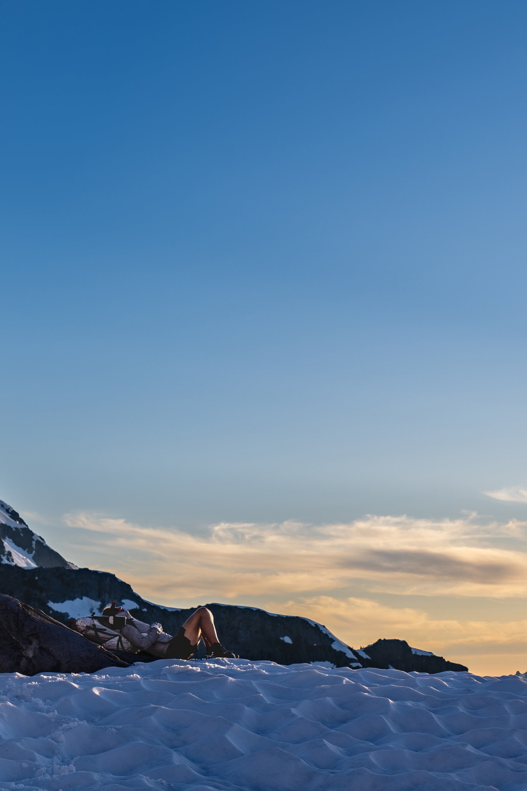
Ultralight backpackers hiking through an icy field

The Alsek is often referred to in one breath with the adjacent and more commonly run Tatshenshini River. The Tatshenshini/Alsek is a massive transboundary river complex draining out of the Yukon Interior and cutting through the most massive coast mountain range in the world. Dozens of glaciers squeeze, dam, and calve directly into the Alsek in its 185-mile course to the Gulf of Alaska. The Alsek is no ordinary river trip, and guidebook author Andy Embick suggests that paddlers ask not “Is the Alsek good enough for me?” but rather “Am I good enough for the Alsek?”

After paddling rivers worldwide for the past 30 years, I hoped that I was good enough as we set out floating from Haines Junction. Part of the reason so few people run the Alsek is the absurd bureaucracy involved. Two days of driving from Anchorage were made longer by a mandatory detour to the Dalton Post border crossing near Haines to check in with both U.S. and Canadian Customs. Our patience was further strained by silly questions from Parcs Canada (“How will you cook if it’s raining too hard to use your camp stove?!”) who doubted that we would even make it to our first campsite in our packrafts. Finally, adrift, we were happy to face the comparatively simple river challenges ahead.

The Alsek takes a while to gather itself, but after the merger of the Dezadeash and Kaskawalsh rivers, the speed and volume steadily increase. The first of a series of glacier-dammed lakes is encountered as the massive Lowell Glacier pushes the river up against Goatherd Mountain. Giant icebergs dwarf our little colorful packrafts. Below Lowell Lake, we enter a 45 mile stretch of Class III-IV whitewater.

Ultralight packrafters witness melting glaciers

Most of the rapids are not technically challenging, but at volumes that range from 30,000 to 60,000 cubic feet per second (cfs) we find the river intimidating. We are constantly on edge and bracing through a series of fast corners with breaking waves up to thirty feet tall, giant suckholes, and confused eddy lines and boils. If you come out of your boat, you could swim for miles in this cold and turbulent water. At Lava North, Gunnar hits a hard eddy line, dumps over and self-rescues back into his boat in seconds. The river is a freight train barreling along through a series of S-turns at speeds we estimate at 12 miles per hour. At Cerebus, one of the few named rapids, we paddle beneath an orange mountain wall that rises 4,000’ straight out of the river, perhaps the single most dramatic river moment of my life.

To give our nerves a rest, we break the whitewater section up with camp at Super Cub Creek, just another glacier-fed tributary dumping 5,000 cfs into the Alsek. These muscular tributaries seem to come every few miles as the volume keeps pumping up. We later find out that the Bates Canyon river gauge recorded 48,000 cfs that day, the second highest water level ever measured on the Alsek. By the time we reach Turnback Canyon the river volume is closer to 60,000 cfs, three times more water than the highest volume I have ever paddled on the Grand Canyon.

Turnback Canyon is no place for a packraft. At one time it was thought to be more fearsome than Devil’s Canyon of the Susitna and the Grand Canyon of the Stikine, but successive parties have rated it at Class V or V- at normal flows. Most parties floating the Alsek summon a helicopter to portage Turnback Canyon, which is formed where the Tweedsmuir Glacier pinches the river against the mountains. With packrafts, the eight-mile portage across the glacier is a mostly-pleasant walk on dead white ice, with only a short section of loose moraine rock to stumble through. The portage is not always a cakewalk, though. When the Tweedsmuir Glacier is surging, the surface becomes fractured with crevasses, and the portage can be difficult or impossible.

When we reach the end of the glacier a giant boil of water fountains up out of the base of the Tweedsmuir adding another 10,000 cfs to the Alsek. The problematic whitewater is over beyond the Tweedsmuir, and more time is freed for noticing scenery that has become run-of-the-mill spectacular. Oh, there’s another enormous glacier. And another massive river flowing into what is becoming a fast-flowing ocean. We float 20 miles to our next camp at the confluence of the Tatshenshini in two hours, look at each other and decide to press on for another 15 miles to the Walker Glacier.

It used to be that the Walker was popular for walking. Now it’s known as the Looker because it has receded and broken up so much as to be unwalkable. On downstream we wind past dozens of glaciers, all showing clear signs of retreat. I suppose someday this will all be good bottomland farm country, and our glacier photos will be relics of a bygone era. I am happy to be here now. Perhaps if my karma is good, I’ll be reborn at a time when Turnback Canyon is a pleasant float on clear blue warm water.

Ultralight packrafters floating the Alsek River

The last glacial hurrah comes at Alsek Lake as the river pours into, under, and through building-size bergs that have descended Mt. Fairweather and the surrounding peaks. The coast is clear for the moment, so we head for it, eating as much as we can to lighten up for the walk to Yakutat. Since we’ve come loaded for whitewater bear, our packs will be heavy on the hike, but packraft style says you walk when others fly.

The constant throughout the trip has been change, and the maps become useless as we navigate to the mouth of Dry Bay. Coastal erosion is the companion to the dramatic glacial retreat so evident along the Alsek. Our Gaia GPS often says we are on dry land while we paddle, or in the ocean as we walk. Packrafts allow us to embrace impermanence and literally go with the flow.

I remember this stretch of the Lost Coast from a few years back when I went south to Glacier Bay. It’s 15 miles to the Akwe River and dry the whole way, so our packs top 75 pounds carrying fresh water. The adage “fly an hour or walk a week” often comes to mind as we see small planes flying up the coast to Yakutat. The nice thing about walking north is that the Akwe and Ahrnklen both flow that way, so we get off our feet for nearly 20 miles out of the 45 to Yakutat. We dawdle up the coast, well ahead of our 15-day schedule because of the racetrack speeds of the Alsek. The public use cabin at the Italio River is a nice break from the coastal rains and mosquitos and gives us a chance to eat more and rest our feet.

Ultralight backpackers walk along a beach

The beach walk to Yakutat gives us plenty of time for contemplation. One repeating question is why we hadn’t thought about doing this trip before. It’s easily one of the top five trips of my lifetime, and it’s been here under my nose all these years. The reality, though, is that packrafting the Alsek wasn’t really a viable idea until a few years ago when packraft evolution made it so. Cargo fly storage, bomber spray decks, sophisticated hull design, and effective thigh strap systems all contribute to making packrafts suitable for a big, wild river like the Alsek.

After 12 days on what we all agree is one of the greatest packrafts routes in the world, we roll into Yakutat for beer and burgers, gratified with the opportunity to feel small in a wild world that is quickly vanishing.