


Words by Peter Bugg @plbugg, Photos by Peter Bugg, Scott Countryman, and Jim Sulak
 “You know…34 degrees isn’t that cold when it’s sunny out,” Bobby said to me out of nowhere. As surprised as I was at the commentary, I had to admit he was right. It was around 9am on a still December morning, and we were at about 6,600 feet, hiking along a forest service road on the South Rim of the Grand Canyon. A very generous friend had just driven 6 of us 30 miles west of Grand Canyon village and dropped us off to begin our trip. We were planning on spending the next 5-7 days hiking 50-some miles back towards park headquarters, where our cars were waiting for us, as long as we could get to the South Bass Trail.
Despite the low temps - for Phoenicians - we were in high spirits as we had recently overcome an unknown variable that had concerned us. The backcountry rangers we spoke to the night before had informed us that recent rains had deposited ample drinking water in the side-canyons we would soon encounter, but there was also the possibility that the precipitation had created muddy sections on the approach that could stick a vehicle if we weren’t careful. Luckily, our early departure ensured that any wet spots were still frozen and easily drivable, and we wouldn’t have to spend TOO much additional time road-walking to our trail. Altogether, this meant we were ready to start our adventure.
Our rough plan went like this: 6 miles along a dirt road through juniper and pine trees to the trailhead, 5 rocky miles down the South Bass Trail, 29 miles back east along the Tonto Trail, with a final ascent on our last day up Boucher and Hermit Trails to our trucks. I had hoped to do this same route two other times, but was stymied on both attempts - once from cold, and once from wind and a dearth of hiking partners. Despite some rain forecasted later in the week that almost caused two of my companions to drop out at the last minute, a little peer pressure - “Kristen, your Phoenix is showing!” - convinced them not to bail, and things were looking up.
 The forest along the South Rim obscured the views I have come to love and expect in desert hiking, but the flat, clearly defined path made for quick going, so the first six miles were pretty painless. I had driven this section of road to do a different section of trail in early 2020, but post-COVID access via the Havasupai Reservation has been cut off by the tribe, which gave us a few warm-up miles as a bonus. It took about 2 hours to reach the rim, where we took a quick break to de-layer, refuel, and rehydrate before beginning our descent.
Making your way down into the Grandest of Canyons is always a treat, but the day’s combination of blue skies, very comfortable midday temperatures, and an incredible feeling of solitude and stillness as we gazed on miles of unpopulated wilderness made this one particularly special. We descended through eons of rock layers, passing various signs of Indigenous habitation while ravens lazily circled overhead. We paused briefly for photos with agave stalks, a bit longer for snack breaks, and punctuated our trail chatter with appreciation for the panoramic vistas that made all the planning and logistics worthwhile. After about 5 miles and 3,400 feet of elevation loss, we found ourselves at the crossroads where it was time to stop descending and begin maintaining elevation along the Tonto Trail. Three of us used this opportunity for a slightly longer break to rest and repair sore feet and joints. The other half of the group headed a bit farther down trail to collect and purify drinking water for everyone. As the rangers had advised, known potholes, AKA tinajas, provided ample hydration, and we took this as a good omen for the rest of our journey.
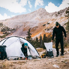
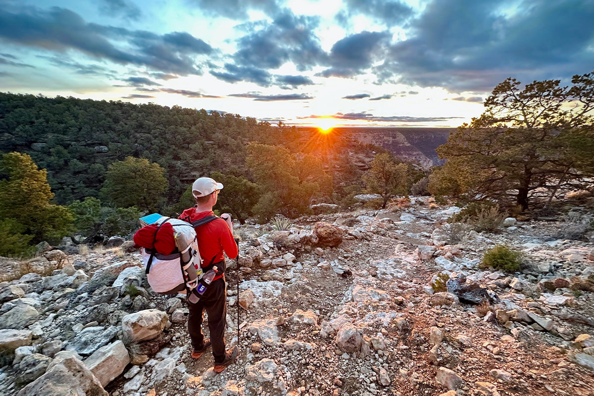
 Our last section of trail for the day was 2 miles of traversing on the Tonto platform. Despite the day’s flat and downhill trend, 13 miles with packs weighing in at around 40 pounds (clothes for cold and rain, food for 7 days) had us pretty knackered. Conversation during our final push was minimal as we eagerly awaited dropping our packs and eating a warm meal. The setting sun played against the rocks, dazzling us with new colors around every corner and gently urging us on to our sleep spot. Camp shoes, dry clothes, and pitched shelters gave us a short burst of energy before bed, which was evident in the barrage of bad puns we shared over freeze-dried dinners. Despite our best efforts to stay up until a reasonable bedtime, the early start and long day had us zipping zippers, closing our eyes, and bidding a good night to Orion and the Ursas sometime around 8pm.
Stats: 13 miles, 7.5 hours, 3,400 feet of elevation loss, sleeping along the Tonto Trail between Bass Trail and Serpentine Canyon.
 Day 2 - Let the fun begin! It was only about 10 river miles back to where we would begin ascending to our cars. However, the trail takes a serpentine, sinuous route as it winds along the Tonto Plateau to minimize elevation changes, so we had roughly 27 miles of hiking in store over the next 3-4 days. In warmer months, all of the side canyons might be dry, requiring hikers to make time-consuming side-trips down to the Colorado River to collect silty water for decanting, filtering, and drinking.
 But we were in luck with easy water access close to our main trail, and our journey would be much more straightforward - all we had to do was follow the meandering “trail.” Simple, but not necessarily easy. The trip reports we had read in advance made the task sound like it would require precision, concentration, and an advanced degree. However, we had a group of six well-traveled hikers and extensive MarioKart experience. Every so often, maybe twice per mile, depending on the terrain, whoever was in the lead would pause, having just mentally heard the tire screeching sound effect of his or her cart sliding off the track. This was often cued by a mess of prickly pear cactus spines, and no clear way through, so the leader would look back at the trailing hikers spread out over a few hundred feet, and ask who was still on trail. If needed, we would fan out in search of our path, but it seldom took us more than a minute to regain the route and resume our forward efforts.
 As we walked, the views we enjoyed developed a rhythm of their own: Red Rock faces jutting up to the South Rim beckoned us towards the heads of side canyons, and then distant towers named after immortals from an array of cultures signaled we were pointed back towards the Colorado River. The cycle repeated without becoming repetitive, and we took breaks to appreciate plants, animals, and anything else that caught our attention. Highlights for the day included a family of 5 bighorn sheep, a few tiny mushrooms, and a hibernating poorwill at the end of the day that I briefly misidentified as a yucca stump. I realized my mistake when the bird, known to the Hopi as “the sleeping one,” opened its eyes and ruffled its feathers before settling back in.
Stats: 9 miles, 7 hours, and another early bedtime on Le Conte Plateau.
 Day 3 - As previously mentioned, earlier attempts to do this same route were foiled partly by weather. However, I think they also suffered from overly aggressive itineraries of 3.5-4 days, which would have required less time off work, but also a faster, more tiring pace. My initial plan for this jaunt included an optional rest day, but the forecast rain prodded us to keep moving before we needed to be slowed down by waterproof layers. So on our third morning, we popped the caps of our inflatable sleeping pads and rose to the sound of gushing air that brought to mind whales exhaling on the surface of the ocean - not a common sight in the desert, but still a fun mental image to get us out of bed. We didn’t see any large mammals along the Tonto on this day, but we did see signs of them - three separate bighorn skulls, a single deer antler, and many scat piles from an unidentified desert denizen that later research suggested was a fox.
 As much as I appreciate a quick weekend excursion, I love the rhythm you can find on a longer sojourn. Consuming food for two and a half days had significantly lightened our packs, and we now had enough data to minimize how much water we needed to carry between tinajas - so both the physical and mental energy required to keep us going were much lower, and we could really enjoy our time in the park. We began the day with clear skies, but clouds started to roll in by late morning and continued to threaten as the day wore on. All six of us are either Phoenix natives, residents, or both - which means we are comfortable outside in 90º+ days, but clouds can make us a bit cagey. We stopped twice for water and food, and I repaired a hole in the knee of my pants caused by a scuffle with a cat claw, but for the most part, we kept chipping away at the mileage by shimmying around prickly pear and other pokey desert flora one step at a time.
 If you picture the Tonto trail from above as an abstracted horizontal zigzag line, most of the best campsites with ample flat spaces are either in the valleys - close to water sources - or at the peaks - on points jutting out towards the river. In times of more extreme weather, the valleys also provide highly desirable shade from the sun and/or protection from the wind. Despite the clouds, we were lucky enough to comfortably camp at the promontories with 270º views that sweep down- and upriver. These vast expanses provide ample material for both reflection on recently overcome challenges and inspiration for future adventures, and are better than any prestige content an internet connection could provide on a comfortable couch at home. After the sun went down on our third night, our efficient travel throughout the day left us with more energy than on our first two nights. We didn’t stay awake until midnight to ring in the New Year, but we did entertain ourselves with shadow puppets on the walls of our tent that amused creators and consumers alike. What our silhouettes lacked in anatomical accuracy, they made up for with enthusiasm, and it was a nice cap to a memorable day - and year - on the trail.
Stats: 10 miles, 7 hours, and a slightly later bedtime beneath Geikie Peak.
 Day 4 - As we feared, the rain started after we went to bed on our 3rd evening. It continued on and off throughout the night, but we were extremely fortunate that it was not accompanied by wind, so our sleep was relatively unbothered. One thing about cloud cover that I often forget is that while it insulates against the sun during the day - making for cooler waking hours - it also insulates towards the earth at night - making for warmer sleep. Our first two nights hadn’t been uncomfortable, but having a few extra degrees of warmth on our third night was still a welcome change. In addition to the temperature difference, the clouds that had descended overnight provided a dramatic change of scenery the next morning. Geographical features we had been using as landmarks for the past few days disappeared behind a blanket of fog, and what had become familiar terrain over the previous miles was suddenly foreign and mysterious.
 I understand the discomfort that backpacking in the rain can cause, but I have found that as long as I do a good job of finding dry(ish) windows for taking down and setting up camp, I can usually stay warm and dry enough to keep my spirits up. On this day in particular, I had the added benefit of heading to a campsite I had enjoyed a few years earlier, and the mental image of the luxurious destination awaiting us also buoyed my attitude.
 All in all, the 8 mandatory miles we had to cover went by without incident, and we were set up in our new digs by 2pm, braced for more rain. At this point, half of us decided to take advantage of a lull in the precipitation to rest and relax in camp, and the other half took a side jaunt up Boucher Creek to admire the flora fed by a gushing spring. After a couple of hours, we reunited back in camp just as the rain returned, but were able to comfortably fit the whole group into our Ultamid 4 for some dice games to pass the time as we waited out the storm.

It was at this point that our luck, or maybe morale, finally ran out. Post dice game, we thought we might have the opportunity for a quick dinner uncomplicated by precipitation, but Mother Nature had other plans. Despite our best efforts, we ended up eating our rehydrated meals either huddled in tents or sopping in the cold outside. It was the low point of the trip for me, but it was short-lived after a Snickers bar and a pair of warm socks fixed what was always going to be a temporary problem. Regardless, it encouraged another early bedtime and ample rest for the upcoming ascent.
Stats: 10 miles, but 2 miles without packs!
 Day 5 - We awoke to the warm glow of a sun obscured by cliffs but not clouds. The rain had stopped, and we were ready to ascend. We only had 3.5+ miles to get to our campsite, but we also had 2,600 feet of elevation gain along some steep trails. Climbing uphill can be where different ability levels start to separate the group more than in flats and downhills, and experience from a past trip suggested that the next section of trail could take up to four hours. We wouldn’t have to carry as much water on this go because the potholes at our destination would be full after the previous day’s rain, but I also wanted to go on a quick side-quest and summit White’s Butte along the way. We got spaced out a bit after we left camp, but tried to stay within sight of one another if not earshot. About 2,000 vertical feet up brought us to White’s Plateau, where some rested, and I convinced Jim to join me for the extra credit. It only took about 45 minutes, and the puffy cumulus clouds floating above red and yellow rocks urged us on to the summit register, where we signed our names and took photos for posterity before returning to our group.
 Another hour and change brought us to our proposed campsite under Yuma Point. I’ve slept there twice before, and it would have been beautiful to stay a third time, but the additional elevation and exposure compared to our last few camps would have also made it cold and windy. Finally, it was only about 5 miles and 1,500 feet back to the cars, and we had enough daylight to get through the exposed section before it got dark. After a brief group huddle, we decided to push on, on the condition that we stick together for moral support through cliffy exposed sections. On our final rest break in the Hermit Basin, we re-upped our calories and caffeine, and agreed we felt safe to split up on the last bit of highly-traveled trail up to the rim. Faster members put the additional time on the rim to good use, shuttling cars and evaluating dining options to keep the food swings and hanger at bay after a long trip. A beer and burger among the welcome home aromas of deodorant and shampoo provided enough fuel for the drive home back to our own showers, beds, and families.
Stats for the trip: 5 days, 52 miles, countless memories.

NOTES ON GEAR AND GRATITUDE
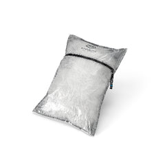
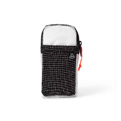
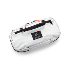
 Rookie of the Year: The Repack. I purchased this accessory a few years ago, but had yet to field test it. Most of my recent trips have been shorter and during warmer weather so it felt unnecessary. This longer trip in colder weather inspired me to employ the Repack for both the weight and space savings, and I was pleased with the performance. Using a sharpie, I wrote meal contents, water quantities, and cook times on the freezer bags I carried the food in, and didn’t have any problems storing or preparing all my freeze-dried meals on the trail. The mitt-style handle had the added benefit of keeping my hand warm while I ate.
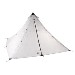
 Veteran MVP: Ultamid 4. This was my second big Hyperlite purchase after my Southwest 55, and it continues to be one of my favorites. Besides providing nightly rain and insect protection for four, it also served as a dice hall for six during a rainstorm, a backdrop for shadow puppets on New Year’s Eve, and a sick bay to treat blisters on more than one occasion. The “eaves” of the tarp even allowed enough space to tuck packs into on the nights that it rained, giving some additional shelter from precipitation. One thing to note when setting up the tent is to make the center pole as tall as possible, which will give you a steeper pitch, which translates to more interior space, better drainage, and increased storage capacity around the edges if needed.
 I had been wanting to do this exact trip since 2020, and I had even tried to push a few times to make it happen, but it wasn’t in the cards. On this specific trip, I had hoped to do some more side-excursions in daypacks to explore the washes above and below the Tonto Trail. But I have learned to try and listen to the universe, and my group members, and adjust plans when needed - so we had a slightly shorter trip, with two full recovery days before we all had to return to our day jobs. Maybe I’ll go back, but it’s more likely I’ll be tempted by other remote trails, peaks, and canyons of Grand Canyon. Either way, I’m incredibly thankful to have people who take time away from their lives and partners to spend time with me, expanding their comfort zones in the wilderness, and I hope to be able to do this for many years to come.