


Words and Photos by Michael DeYoung @michaeldeyoung
 Above the clouds at sunset near our last night on the Mardi-Himal Trek at Badal-Danda and Hotel 360 at 10,500 feet.
Samagaon, Nepal, 11, 585’, December 30, 2025. This is day 11 of 15 on the Manaslu Circuit and I’ve been sick for 10 days with a bad upper respiratory infection. The all night coughing attacks are having a cumulative effect of draining my energy from sleep deprivation. I remind myself that this may be the only time I will ever see this magical location. Unless they haul me out on a stretcher, there was no way I was going to miss out on a potentially great sunrise in a stunning landscape. This is the photographer’s curse. You want the best stuff? Then sleeping in isn’t an option. You go when the light dictates when to be there, regardless of time, cold or how you are feeling.
The 5AM alarm came early but everything was ready. Get dressed, go potty, don the packs and start hiking. In an unheated concrete room in sub-freezing temperatures, you learn to get dressed fast. Our destination this morning is Birendra Lake, a 45-minute hike from town, past active monasteries, with a steep ascent and rocky descent to the lake. With clear skies, I look forward to capturing first light on the high peaks and their reflections in the lake. Half the lake was ice free on yesterday afternoon’s scouting trip, so we were hoping to still find some open water for sunrise reflections. Arriving an hour before official sunrise meant plenty of time to find the best compositions as we watch the grand reveal of the day. As a pro adventure and landscape photographer for over three decades, mornings like this are what I love most about photography and hiking.

Hiking at Birendra Lake, a 45-minute hike from Samagaon. This was a scouting hike on our layover day. We decided to return here the next morning under headlamp to be ready to capture sunrise.
 Sunrise at Birendra Lake at 11,900 feet, below Manaslu at 26, 781’ was a 45 minute hike from the village of Samagaon, where we stayed two nights acclimatizing to high altitude. Although we were there the afternoon before, it was unthinkable to miss this at sunrise when the forecast was favorable for first light. I frequently add a human element to my landscapes (Lauri) for scale and perspective.
Physical effort alone doesn’t guarantee good images but shooting unique locations that require some sweat equity is just much more gratifying than shooting easily accessible and iconic landscapes that sometimes attract busloads of tourists and dozens of other photographers.
A guided tea house trek in Nepal was a departure from our normal self-supported wilderness adventures that include thousands of miles of weeks-long wild river trips in the Alaskan and Canadian Arctic to large section hikes on the Pacific Crest and Continental Divide Trails. In the Grand Canyon alone, we’ve logged 134 backcountry nights from two private river trips and 21 multi-day backpack trips. Comparatively, a teahouse trek in the highest mountains on earth with a guide and a porter seemed like luxury. It was easier than camping but not quite luxury or comfortable. It did mean carrying much less and eliminating time dealing with camps and cooking backcountry meals.
WHY NEPAL? WHY NOW?
A trek in the Himalaya has been a lifelong dream since reading about Sir Edmond Hillary’s Everest expedition when I was in high school, way back in the 70’s. Why didn’t we do this earlier in life? Who knows? The big question now was: why would hikers in their 60’s, complete with the usual age related ailments like arthritis and other degenerative joint damage want to take on a physically demanding mountain trek? Aren’t we past our prime? Isn’t it risky to go to remote corners of the world, especially in winter, where help is far away? Certainly, there are more comfortable and easier adventures but few as rewarding as Nepal and the Himalaya. The right time is now!
In late winter, 2025 I was researching Nepal treks, narrowing it down to a few along with local guides and outfitters. Based on the expense and time required for a trip of this magnitude I was hesitant to pull the trigger and book flights. The popularity of Nepal trekking has increased in the past decade, and big crowds are a turn off for me. I was concerned if there would be enough infrastructure open for a winter trek when crowds would be at a minimum. Most outfitters seemed to discourage winter treks. Based on decades of arctic trips, a winter trek here just didn’t seem that insurmountable to me.
In May, I met our guide, Amrit, a Nepali native and owner of Himalayan Quests, in Kathmandu, by happenstance at a local taco stand in our current hometown of Taos, New Mexico. It was completely organic. He was there visiting a Taos friend who hired Amrit as a guide 10-years prior. So glad I got a chance to speak with him, as Himalayan Quests was mistakenly overlooked as a possibility. He convinced me that a winter trek was entirely possible if we were willing to accept the challenges, and that there were other places with stunning mountain scenery besides the Everest Base Camp and Annapurna Circuit – the most popular treks in Nepal. (He was right!)

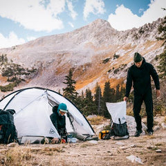
The team on day 2 of our Manaslu Trek, on our way to the village of Jagat, at 4,375 feet. From left to right, the author, Michael, Lauri, Himalayan Quest guide, Kailash, and Himalayan Quest porter, Saroj. I am wearing my typical hiking/photography set up with a large Camera Pod attached to my Waypoint 35 pack. Lauri has the same pack minus the Camera Pod.
Having a personal connection was the tipping point. With our bucket list trip now confirmed we were totally stoked to celebrate the Holidays and bringing in 2026 on the Manaslu Circuit and in the Nar-Phu Valley. Amrit and his team crafted a custom photo centric trek for us. Let the training begin! Looking back, I have nothing but praise for Himalayan Quests. They are top notch and professional in every sense. We would go on another Nepal trip with them without hesitation.

This suspension bridge is one of dozens we crossed on the Manaslu Circuit. Mule trains were commonplace since that is how supplies are sent to villages off the road system. I guess mules don’t get vertigo because this bridge was hundreds of feet above the gorge and you can see through the metal grates.
MANASLU CIRCUIT, NAR-PHU AND MARDI-HIMAL TREKS
There is no shortage of detailed blogs and descriptions about any trek in Nepal, so I am not going to reinvent the wheel here. I’m not a big fan of the day by day style trip reports you see on a lot of personal blogs. On a 26-day trip, doing that would result in a long and boring read. My focus here is on a 30,000 foot overview with personal highlights and observations from the perspective of hikers in their 60’s and as a serious photographer.
MANASLU
Our first trek was a slightly abbreviated journey on the less traveled Manaslu Circuit where I was sick the entire time. This trek followed the Budhi Gandaki River all the way to its source, crossing Larke Pass at 16, 751 feet. Our hike was only 154.5 kilometers or 96 miles. Most descriptions rate it as a strenuous hike. For seasoned hikers used to mountain and desert canyon trails and moderate altitudes, I would rate it in the moderate category. What attracted me here was the mix of authentic rural Nepali village life along with stunning mountain scenery. I loved starting at subtropical elevations where banana and citrus trees grew, climbing to snowbound alpine heights and descending back through lush temperate forests of the Dudh Khola Drainage.

A beautiful dawn alpenglow greeted us about .5 mile south of Larke Pass, our highest point at 16,751 feet. It was a cold 2.5 hour hike leaving Dharmashala at 14, 700 feet around 4:40 AM. I estimated the temperature here to be in the single digits above zero-cold enough to freeze our water bottle and make my fingertips sting a little when operating the camera.
I came to see and photograph the big majestic Himalayan peaks, but I was surprised at how much more there was to see. The stunning heights of the Himalaya and the Manaslu Range did not disappoint. The namesake peak, Manaslu Himal, stands at 26,781 feet, the world’s 8th highest mountain. Standing at an alpine glacial lake at 12,500 feet, I marveled at how much of Mt. Manaslu still towered above us!

First light on Manaslu, 26, 781 feet, 8th highest in the world, from about 20 minutes from the village of Samagaon at 11, 500 feet. My first attempt of photographing Manaslu the previous morning failed because the summit was obscured. The best landscape pictures happen during the best light, and the best light almost never happens when it’s most convenient or comfortable.
Equally impressive was the depth of the Budhi Gandaki gorge, narrower and deeper than the Grand Canyon in the lower reaches of our trek. The river itself was captivating due to the color, technical rapids and dozens of suspension foot bridges we crossed. As river runners we spent time analyzing sections runnable in our packrafts and being terrified by the sections that would kill us in an instant. The forests were surprisingly enchanting as well. In my eyes they were a magical mix of big firs, pines, birch, rhododendron, magnolia, and even bamboo below granite walls and peaks that towered 10,000 feet above us.
 The Depth of the Budhi Gandaki River Gorge was absolutely breathtaking but difficult to capture its scale in a photo. The Manaslu Circuit follows this river north all the way to its source tributaries, going over Larke Pass. This view is from the Village of Deng at 6000’, with subtropical vegetation. The alpine peaks seen to the north rise to 19,300 feet. Shown here is 13,300 feet difference between peaks and the river level. By comparison, the Grand Canyon North Rim to the Colorado River is 5,700 feet.
We came here for the landscape and culture, not the food and accommodations. Good thing, because the teahouses are a far cry from the quality and charm found in European huts and refugios along popular hiking routes in the Alps and Dolomites. Electricity was spotty and unreliable. WiFi was the same way but that was much less important to us than it was to other trekkers. We knew all the teahouses were unheated but underestimated just how cold they would be. The only heat we had was in the common dining areas where the teahouse host would sometimes fire up the woodstove for dinner but never in the morning. On several mornings, at the highest altitudes, water bottles froze in our room inside insulated cases. The toilets were not flushable in the mornings due to ice. We slept in our 10 degree quilts in layers and sometimes with the heavy blankets provided by the teahouses over our bags. These were all challenges that were overcome with the right attitude.

Coming into the village of Namrung at 8,600 feet on Christmas Day.
We came prepared for cold weather and hiking long distances on snow and ice. Even after the huge late-October snowstorm this region received, the snowpack was surprisingly sparse. We experienced patchy ice overflows on trails at higher elevations (above 10,000’) but the only consistent snowpack we encountered was going over Larke Pass where consistent snow began around 15,000’.
For over a week there were rumors about whether Dharamsala (which apparently means refuge or shelter), the last teahouses before Larke Pass would even be open. Fortunately, due to several groups needing this accommodation, one teahouse opened for us. This bare bones remote outpost is only there to serve trekkers, shortening the crossing of the pass to only 12 miles before reaching Bimthang on the other side.

I met this young weaver in the village of Deng, 6,000 feet, on Christmas morning shortly after sunrise as we began our hike for the day to the village of Namrung. I asked our porter to ask her if I could take a few photos. She graciously accepted. In retrospect I wish I spent a few more minutes with her taking pictures.
Just before sunset, I, Lauri and the other trekkers were soaking in the last of the barely above freezing sun at 14, 700’ two mule teams arrived to drop off supplies. That was the extent of our New Year’s Eve celebration. After a late dinner of Dal Bhat again, huddled next to the woodstove burning cow and yak dung, we piled into bed near 9PM. The 3AM alarm would come early.

A mule at the back of the train awaits to be unloaded late in the afternoon. This is from Dharamashala, a basic outpost at 14,700 feet, a 3 hour hike from our last real village, Samdo. This is where trekkers stage to cross Larke Pass the next day.
New Year's Day, 2026 has to be the most memorable in my lifetime. I was excited to bring in 2026 by tackling our highest point, Larke Pass. Our goal was to make to the pass at first sun, but we fell about a half-mile short. There was a fair amount of snow above 15,000 feet, leftover from the heavy late-October storm that slowed our pace some.
Our approach to the pass was uneventful, just slow and cold. The dawn was crystal clear and calm. Leaving at 4:30AM we passed the other groups of trekkers who started before us and were first to arrive at the prayer flags at Larke Pass. It seemed like two prior trips to Peru reaching the same altitude in addition to our training in New Mexico really paid off. I felt no effects from the elevation. Never once did either of us take any of the Diamox we brought with us. The dawn light was fantastic, but I struggled to keep my fingers warm in the single digit temperatures. Our descent was another story. The only time we used our Kahtoola Microspikes was on this morning and they were a lifesaver.
We didn’t arrive in Bimthang, our next resting stop for two nights, until 3 in the afternoon. The steep and icy descent for the first 1.5 mile, took longer than anticipated.
 Sunrise enroute to Larke Pass, the highest point on the Manaslu Circuit.
 The team at Larke Pass. From left to right: Porter, Saroj, Lauri, me, and Guide, Kailash.
Winter is the quiet season, but we encountered more trekkers than I thought. I think as numbers of trekkers increase during the ideal season; more are willing to trek in the off season. December and January are very dry months-almost too dry. In 26 days, we saw
only three cloudy days which resulted in about 10 minutes total of snow showers. Our biggest weather issue was haze and pollution trapped under persistent high pressure. These conditions impacted my photography more than our hiking itinerary. We were only able to escape its grip at the highest elevations, furthest from populated valleys, and well above the inversion trapped smog.

Highlights: The stunning scenery and multiple opportunities to photograph Manaslu and other big peaks at sunrise. People watching and walking around villages: We made it a point to get out and explore and observe daily life in villages we stayed in instead of doing what most other trekkers we saw doing- hanging out in the common dining room glued to their phones. Despite the language barrier most people were warm and friendly. The beauty of the river and depth of the gorge were immensely impressive.

Hanging out with the local kids in the Village of Samagaon. They came out to greet us and we played a game of screaming and chase. This is where the smartphone camera was advantageous to using my Canon R6 with a big lens. Smart phones are such a big part of the cultural fabric now, they are largely ignored even with a camera pointed directly at them.

Traffic hour in late afternoon in the village of Samagaon, where we spent two nights acclimatizing to the elevation.
Challenges: Unreliable electricity, frozen water pipes, using icy Nepali toilets and limited
menu items which resulted in hiker’s hunger.
Starting Point: Machhakhola, 2854 feet, 870 meters (arrived here by private Jeep from
Kathmandu)
Ending Point: Tilije, 7545 feet, 2300 meters where the road started again, eliminating 2
days of trekking.
High Point: Larke Pass, 16, 751 feet, 5106 meters
Total Distance Hiked: 96 miles, 154.5 km, not counting 2 side hikes on layover days
Total Days: 15 including 2 layover days
Most Scenic Villages: Samdo, Bimthang
Coldest Mornings: Bimthang, near zero degrees.

Quite possibly the most picturesque settlement (all teahouses, no real village) was Bhimtang on the west side of Larke Pass, 12 miles from Dharmashala. It sits in a high valley, with a recently receded glacier close by, surrounded by 19,000 to 26,000 foot peaks. Due to the geography, it was also the coldest village along the route with morning lows being near zero degrees. These north facing peaks get virtually no direct sunlight in mid-winter, so I photographed them under full moonlight.
NAR-PHU VALLEY
Our second trek had us exploring the even colder and more remote Nar-Phu Valley for another 10 days. The stark desert landscape with warm colored rock formations beneath snow clad peaks is what attracted me to this trek along with the Tibetan village culture. Unfortunately, this trek was cut short. The two longest hiking days on our trip were an out and back from the village of Koto to Meta, at 11,680’ - a 13 mile, 3600’ ascent crossing some icy sections with marginal traction. My symptoms got so bad after one night in Meta, that we had to pull the plug on the Nar-Phu Valley trek and get to Pokhara, the adventure hub of Nepal at less than 3000’ with a much warmer climate. There I sought medical help and was mostly recovered after 4 days rest in a modern hotel in the heart of downtown close to Phewa Lake.

The trail from Koto to Meta (the approach to the remote Nar-Phu Trek) goes under an overhang with an active waterfall (icefall in winter) at about 10,000 feet level, with solid ice covering the trail under the overhang. We left our Kahtoola Spikes behind but with careful walking we safely passed the roughly 75 foot crossing no problem.
 Lauri getting a puppy fix at the only teahouse open in Meta, our first and only stop on the Nar-Phu Valley Trek. Shortly after, we began our 13-mile, 3,600 foot descent back to Koto and eventually to Pokhara where I had to seek medical help from 17 days of sickness with no relief in symptoms.
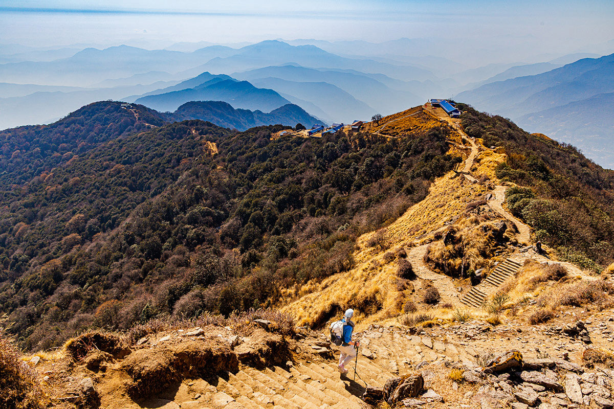
MARDI-HIMAL-A GREAT INTRODUCTION TO NEPAL TREKKING
With another week to kill before our return home (changing our flights for earlier departure was too expensive to be a realistic option) our guide put together a last minute plan to trek the Mardi-Himal for 6 days. This 25-35 mile trek starts only an hour from Pokhara. If you are new to mountain trekking or don’t feel like tackling a more strenuous trek with more extreme altitudes, like the Manaslu, this Mardi-Himal trek would be a great place to start! It’s also a trip you can do without hiring a guide, though I recommend having one.

I got up for every sunrise on our treks except for one - that last day. This view of Machhapuchare (Fishtail) of the Annapurna Range was from our first teahouse on the Mardi-Himal Trek. There was so much haze that morning that I didn’t think anything good would come from this first sunrise. The light was a bit weird and the peak at first just didn’t seem clear and sharp. But then for about a minute or two, the sun got intense enough to make a shot that I didn’t think would be successful. The Hotel 360 cleared the trees at the teahouse enough to get this view.
For photographers, the sweeping views of the Annapurna Range, including the iconic Machhapuchhare (Fish Tail Peak), towering almost 23,000’ above the surrounding lowlands, were a visual delight, especially on the upper reaches of this trek, from Badal- Danda all the way to Mardi-Himal Base Camp. This trek is Nepal’s version of a hut to hut trek found in the Alps and other places in Europe. There are many teahouses along this route, all there to serve trekkers. There is almost no cultural aspect to the Mardi-Himal.
SAVING THE BEST FOR LAST
Speaking strictly from a photographer’s perspective, our last full day trekking was the most productive and inspiring of our entire trip. It started my favorite way with a 4:30AM departure, crunching cold snow underfoot and seeing your breath in the beam of your headlamp. A brutal 2100 foot climb in 1.5 miles (steep!) led us to another stunning location high above High Camp to see a grand reveal of the new day.

For mountain landscape photography foregrounds are an important part of the image. I just don’t want to point my camera at distant peaks from a sweeping viewpoint. We started our last and most productive photo day with a 4:30AM departure from High Camp. It took us 1.5 hours to climb 2,100 feet in 1.5 mile. As the day was evolving, I was nervously searching for the right foreground to place in front of first light on Annapurna South. Hiking another half mile up we found these prayer flags at a closed teahouse. They served as a unique foreground that helped establish that all important “sense of place” for a photo. The foreground makes this uniquely Nepali. What a great last day this started out to be.
Fortunately, the smog that has plagued me with less than ideal light for much of this trip was temporarily gone and it was a delight to see crisp mountain detail in the emerging morning light. I love it when I get the best images of the day before most other trekkers have their first cup of coffee. After an invigorating descent to Badal-Danda and an afternoon snoozle, we ended the day with a great sunset above a sea of inversion trapped low clouds over the Pokhara Valley. What a great way to end our trekking days before returning for a hot shower and great Indian food.

Above the clouds at sunset near our last night on the Mardi-Himal Trek at Badal-Danda and Hotel 360 at 10,500 feet.
Highlights: Sweeping views of the Annapurna Range with earlier and later light, warmer
temperatures than similar altitudes on the Manaslu. Below 10,000 feet it was downright
pleasant for mid-January. The upper elevations were only stingingly chilly in the
morning. Afternoons were quite nice, even at 11,000 feet.
Challenges: More crowded than I prefer (hundreds of trekkers vs two dozen on the
Manaslu), and this was the off season! Endless stone steps that were quad killers on
ascent, and too short for my size 13 feet and long gate on descent. However, their
purpose is to keep the trails from washing away during the wet monsoon season.
MARDI-HIMAL TREK AT-A-GLANCE
Starting Point: Phedi: 3707 feet, 1130 meters (arrived here by private jeep from
Pokhara)
Ending Point: Sidhing, 6000’, 1830 meters (private Jeep back to Pokhara)
High Point: Way above High Camp: 13,700 feet, 4191 meters
Total Distance Hiked: 27 miles, 44 km
Total Days: 5 days, 4 nights
Favorite teahouse views: Badal Danda

Hiking past prayer flags shortly after sunrise toward Mardi-Himal Base Camp at approximately 13, 700 feet below Machhapuchare (Fishtail) in the Annapurna Range. This was our highest point on our Mardi-Himal Trek.
“Ultralighting” is the hiker’s buzzword these days and it means different things for different people, but it isn’t just for long US trails and young people. It’s beneficial for every style of hiking and all age groups. It made our hard winter trek at high altitude easier and more enjoyable. It is nearly impossible to be a true ultralight hiker as a serious photographer even with the lightest mirrorless DSLR and lens. Our focus on lightening everything in our backcountry arsenal without sacrificing function and quality is what allows me to carry photo gear on adventures with relative comfort.
WHERE ARE THE OTHER SENIOR TREKKERS?
Everywhere we went, we were the oldest trekkers at age 64. There were only a few trekkers that were close to us in age. We heard rumors of a 65 year old man from Japan behind us on the Manaslu Trek but we never ran into him. Surely, during more popular trekking times there is more senior representation. C’mon retirees! Most of us have more time now to dedicate to fitness and adventure.

In between treks, Sarangkot, the most popular spot to watch sunrise on the Annapurna Range from Pokhara. We did a little exploring while I was recovering. There were hundreds of people here for sunrise along with other photographers. The views are great and the photos are “easy pickins”. It’s fun for a day or two but I much prefer backcountry views.
We may be past our prime physically, but our lust for adventure and visiting wild and big landscapes has not decreased with age. In fact, it may be the opposite. With fewer years ahead of us than behind us, there is a sense of urgency to experience as much wilderness as we can in our time left. That is a huge motivator for staying in the best shape you can maintain, because no matter how healthy you are, one day you will no longer be able to do things like this. I’m postponing that for as long as possible.
You are never too old to start enjoying the backcountry or for improving your physical fitness. Don’t let age deter you from continuing to participate or getting into adventure. Age and wisdom help us recognize and remain within our limitations. It’s rarely too late to get into physical condition. Even if you have little interest in backpacking and thru hiking, there are unlimited adventures that are guided and outfitted all over the world, and mountain trekking in Nepal would be hard to beat. Learning to go as light as possible is still greatly beneficial.
TRAINING FOR A HIGH ALTITUDE NEPAL TREK
A big trip is great motivation for some sort of training regimen. Ideally, we would all maintain a level of fitness to where you don’t need to “train” for an expedition. You just go do it. But life isn’t ideal for most of us and even though we do regular cardiovascular training, I felt specific training for this trip would pay dividends. It certainly did!
Due to steepness and altitude, hiking in Nepal is different from long distance backpacking in the U.S. Daily distances are usually modest. It would be a shame to make a trip there all about maximizing daily miles instead of taking more time for full immersion into one of the most inspirational landscapes on earth. Nonetheless, trails were no joke and required some physical effort.

I swear, at least half of the 25 miles one way to the upper most teahouse on the Mardi-Himal were comprised of steps like these as we are climbing toward Badal Danda below Annapurna South. I’ve been training on a Stairmaster at the gym on days I wasn’t hiking steep trails either in the Grand Canyon or in Northern New Mexico. That was the best training we could have done for treks in the Himalaya.
Least Important: Long slogs with heavy packs even on flat terrain are great training for a thru hike and are better than no training. Unless you are going on your own (the Manaslu Circuit and other remote treks require a guide) there is no need for a heavy pack. With the total expense of trekking and airfares, a few hundred more dollars for a porter was well worth it and you are contributing more to the local economy. Our longest day was 13.5 miles with a 3600’ climb. For seasoned long trail hikers these are modest distances. The energy expenditure on our 12-mile day crossing of Larke Pass was greater than my longest day, (26 miles) on the Washington PCT.
Most important: Hiking steep terrain at high altitudes is the best way to train for a Nepal mountain trek. Not everyone has that luxury, so most Nepal guides incorporate acclimatization days. However, the more you can train prior the better off you will be. There are many trails and day hikes that get you above 12,000’ in New Mexico, Colorado (CDT through South San Juan and Weminuche Wildernesses) and California (JMT and PCT). I think the best trails for training (excluding altitude) are in the Grand Canyon, particularly Bright Angel and South Kaibab. Grandview is even better. In the U.S., these Grand Canyon trails will prepare you the most for Nepal’s endless and steep stone-step trails sections.
Many folks just don’t have time to spend a month or two in Colorado, New Mexico or California to get hikes in at altitude, so what is the next best thing? If you are doing cardio at the gym, using the Stairmaster (or equivalent is the way to go. Using these machines will pay huge dividends for mountain hiking over treadmills and elliptical machines.
Having the latest and greatest cool ultralight gear isn’t a substitute for sweat equity. Get up and do it. In all weather. No matter how you feel. Consistency is the most important thing. Hiking regularly is a lot better than widely spaced grunt hikes. Lauri and I hiked five days a week for nearly three months prior to going. In the end it really paid off. Our training hikes near home were more strenuous than most days on the trail in Nepal.
40 years of backpacking experience in Alaska, the Rockies, Cascades, Sierras and the Desert Southwest were a huge factor to our success in Nepal. With our experience negotiating stream crossings, dealing with ice, snow, mud, landslides and steep exposed sections with loose gravel meant there were no really challenging trail sections for us in Nepal. You are never too old to start or restart hiking and backpacking as long as you keep your goals realistic and within physical limits. Test your limits at home with easy bail out options first.
OUR GEAR
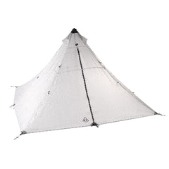
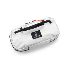
Pack: HMG Waypoint 35
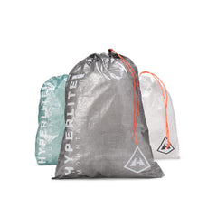
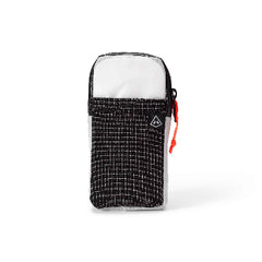
Pack accessories: HMG Shoulder Pockets on each shoulder strap, 3 HMG Camera Pods - large, HMG Pods
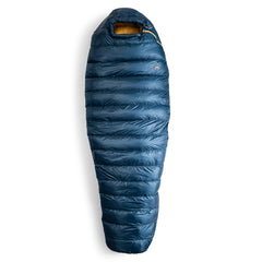
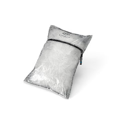
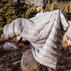
Sleep: 10 degree quilt
Layers: Puffy hooded jacket, rain pants and rain mitts, Patagonia Calcite Alpine Jacket Patagonia Nano Puff hooded jacket, Patagonia Nano Puff mitts, Simms wool fingerless gloves, Nepal style fleece lined wool hat that can be tied under the chin, Arc’teryx quick dry hiking pants (don’t remember the model)
Shoes: La Sportiva Bushido II, not waterproof, with Kahtoola INSTAgaiters, La Sportiva Ultra Raptor ankle high GTX (only used these 3 days for Larke Pass and from Koto to Meta, the approach to Nar-Phu Valley, Kahtoola Microspikes, Outdoor Research Helium gaiters for snow and rain.
Light: Nitecore NU 27 headlamp
Water: 1-liter Nalgene Bottle in Outdoor Research insulating case for cold weather, 1 Smartwater bottle for lower elevation use, Sawyer Squeeze filter. (Very easy to filter all our water, less expensive and more environmental than buying bottled water every day.)

Doing a gear shake down for a Mardi-Himal Trek at Hotel Barahi in Pokhara.
ARE YOU A SERIOUS PHOTOGRAPHER AND HIKER/BACKPACKER?
Then this narrative might be of value. If not, you can probably skip this section. My mantra for backcountry landscape and adventure photography has always been “carry less, shoot more.” Most outdoor photographers are bogged down with too much gear. We’ve never lived in a better time to be an outdoor photographer with a large selection of high performance, quality photo gear that doesn’t become a ball and chain when you have to carry it into the backcountry.
The ongoing debate about the best camera amongst thru hikers and those embracing ultralight travel who are serious about photography is, a smart phone vs DSLR. My iPhone 17 Pro was an invaluable camera on this trip. (More on this later.) If you want image files capable of gallery quality prints, like I do, as well as a camera that can handle a variety of challenging photographic scenarios and want maximum creative control, then there is no debate. A smart phone camera, regardless of sensor size is no match for the image quality and performance of a quality mirrorless camera with interchangeable lenses.

This was the last shot of the sunset on our last evening on the Mardi-Himal. It was a great way to end our trekking. This last day was the most productive photo day I had on the entire trip. Earlier, before the sun sank below the horizon, I made another series of hiking and landscape shots from our teahouse at Badal Danda. About 20 minutes after the sun went down, I know the colors would get more intense. They did.
Apples to Oranges: The iPhone 17 Pro has a 48mp sensor. The image quality from the
iPhone doesn’t even come close to that of my Canon R6 Mark II which has a 24mp full frame sensor. My Canon R5 has a 45mp full frame sensor and it’s not even worth comparing. Sensors are not created equal. Each pixel site on the Canon is deeper and contains so much more information even in JPEG format than a pixel site on a smart phone’s sensor. In addition, the lenses on the iPhone which are literally the size of a thumbnail, do not have the resolving power, contrast, color or sharpness of a quality DSLR lens.
A smartphone certainly has its place as a useful camera. It is especially useful for candid cultural subjects and for street shooting. Locals in particular were leery and intimidated when I tried to make photos with my R6 even with a small lens. Most people pretty much ignore a phone pointed in their direction so using the iPhone allowed me to get images I would have otherwise not have captured. If you understand and work within the lighting and performance limitations of the iPhone, you can get some pretty amazing images from it.

These young girls in the village of Samagaon were very intrigued by Lauri and me walking around town and came over to us where we got into a game of hide and seek. When I tried to photograph them with the big camera, they all ran and hid. Using the iPhone 17 Pro, they went back to acting as they were at first. Winning their trust allowed us to capture candid photos of them, but only with the iPhone.
For bucket-list and once-in-a-lifetime landscapes of the Himalaya, putting them on my R5 with quality lenses was the only way to go. Anything less was just unthinkable. My R5 with my go-to 24-105mm/f4 L-series travel lens weighs three pounds, and I carry it in the large HMG Camera Pod. It is attached to my shoulder straps via small carabiners. The Camera Pod is the lightest and best chest holster I’ve ever used. I have four of them and use them to carry all my cameras and lenses. It takes a few seconds longer to take off and put back on your pack, but having my camera easily accessible on my chest is just great.
 My Nepal trekking camera set up attempting sunrise on Mt. Manaslu, 26, 781’ from the village of Lho at 10, 400 feet. Featured here are my Canon R5 with a Canon RF 24-105mm/f4 L lens on a Benro Tortoise Series 1 carbon fiber tripod and a Really Right Stuff BPC-16 Micro Ball Head.
 This was my first attempt at capturing first light on Mt. Manaslu at sunrise from the village of Lho. The summit was obscured but fortunately, I had several other sunrises on successive days where I captured clear photos of this peak from other places along the trek.
WHAT I CARRIED IN MY HYPERLITE MOUNTAIN GEAR WAYPOINT 35 PACK WITH THE LARGE CAMERA POD
• Canon R6 or R5 with a Canon RF24-105mm/f4 L lens attached. Each body had a Really Right Stuff Arca-Swiss compatible custom plate
• Canon RF 70-200mm/f4 L lens in separate camera pod
• Breakthrough Photography X4 polarizers for each lens
• Extra battery and media cards in Think Tank Media Card Wallet and Battery Holder
• iPhone 17 in a Shoulder Pocket
CARRIED BY MY PORTER AND USED AROUND CAMPS FOR SUNRISES AND SUNSETS
• Canon R6 Mark II as a back-up camera and a body .5 pound lighter than the R5 I
• carried around villages
• Canon RF 20mm/f1.8 L lens. This was my widest angle and go-to night lens
• Benro Tortoise Series 1 Columnless tripod legs (I discarded the head it came with for
• something more compact and better)
• Really Right Stuff BPC-16 Micro Ball Head
• Nitecore Carbo 20000 mAh power bank - strong enough to recharge a battery in the R5.
• Nitecore Pro battery dual charger for Canon LP-E6N batteries
Michael DeYoung is a photographer, a wilderness traveler, and a weather guru who, together with his wife and adventure partner Lauri, has bucked corporate tradition and forged a life as a freelance adventure and travel photographers in the '90s. They have shot campaigns for a wide variety of tourism clients and outdoor publications, including many assignments promoting Alaska as a visitor destination. When not out in the wilderness, they spend their time near Taos, New Mexico, in a 100% solar-powered, sustainable straw bale home and office. Michael has turned more toward leading and guiding photography workshops and uses his meteorological expertise to teach others forecasting for wilderness travel and finding the best photographic light.
Portfolio: michaeldeyoung.com
Photo Tours: Active Photo Tours
Instagram: @michaeldeyoung
Sign up for our Newsletter