

Quick Summary
- After completing an eight-day, 131-mile trek from Pangnirtung to Qikiqtarjuaq, Caleb and Henry’s expedition crossed through the spectacular landscapes of Auyuittuq National Park, passing landmarks such as Mount Thor, Mount Asgard, frozen alpine lakes, and glacial rivers before descending to the coast. With hiking, river crossings, packrafting, and challenging travel across rapidly melting sea ice, the team navigated cracks, melt ponds, and icebergs while adapting to constantly changing conditions. Along the way, they experienced the arrival of Arctic summer, with blooming wildflowers, mosquitoes, and sightings of Arctic hares, and even spent a day assisting sea ice researchers in exchange for a meal. Having reached Baffin Island's east coast, they are now preparing for a much longer and more demanding month-long section toward Clyde River, with their route dependent on evolving sea ice conditions.
Words and Photos by Caleb McDaniels @calebjmcdaniels and Henry Penfold @hpenfold
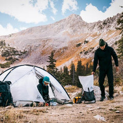
 Two nights ago, we pitched our tent on the outskirts of Qikiqtarjuaq, a small community on Broughton Island. Our arrival marked the end of our shortest planned section, eight days and 131 miles from Pangnirtung.
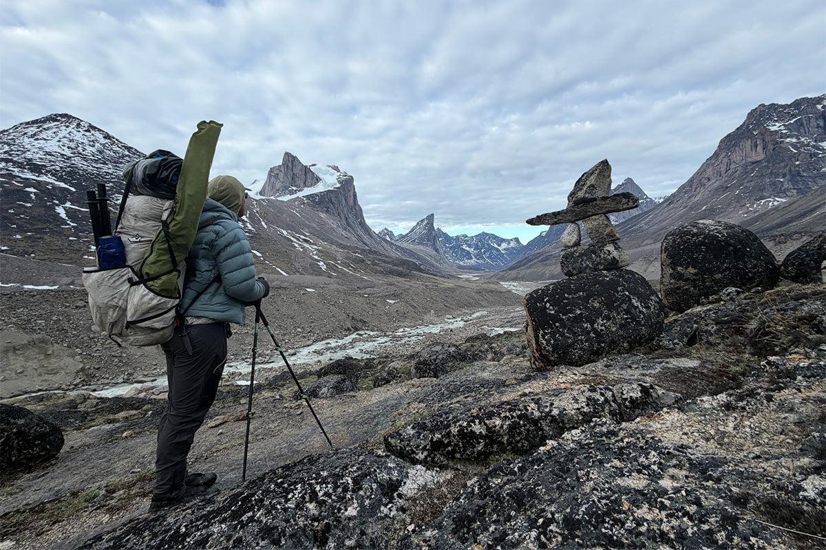
 Much of this leg carried us through Auyuittuq National Park, famous for its imposing mountains and glaciers. Crossing the Arctic Circle, we followed the Weasel River past a series of high waterfalls and steep moraines. We soon passed beneath Mount Thor, frequently stopping to gaze up at the world’s largest vertical cliff. Continuing through Akshayuk Pass, we crossed two frozen alpine lakes and enjoyed prime views of Mount Asgard. We quickly agreed that Asgard’s flat-topped granite tower was the most remarkable piece of rock either of us has ever seen.
 As Asgard receded in the distance, we forded several bitingly cold rivers and began descending alongside the Owl River. We floated a few blissful miles in our packrafts as we approached the river’s mouth, where the valley opened into a fjord.
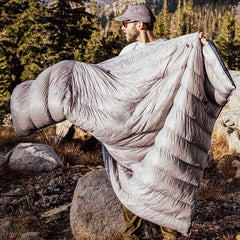
 Walking with light packs on trails worn into scree fields and river banks, our days in the park felt like a miniature hiking holiday in the midst of our longer journey. Our holiday ended when we climbed onto the fjord’s rapidly melting sea ice. Traveling over this ice proved to be an entertaining challenge. At times, long expanses of solid ice allowed us to cover ground quickly. Elsewhere, we slowly picked our way through mazes of thin ice riddled with melt puddles and holes. Wearing our drysuits and PFDs, we had great fun leaping between plates of ice, occasionally inflating our boats to cross wider gaps. Over the course of about 50 miles on the ice, we managed only a handful of brief and refreshing dips in the water. At the end of one day, we found ourselves paddling icebergs to make the last few hundred feet to shore. Icebergs are cumbersome as boats go, but glide pleasingly if enough effort is invested in building momentum.
 On the solstice, we impressed ourselves by sleeping for 22 hours, nearly setting new personal records. This feat was driven partly by our exhaustion after several long days and partly by our reluctance to venture out into the wind and rain. When we finally emerged from the tent, the wind had cleared a channel in front of our campsite, allowing us to paddle a short stretch.
 It feels like summer has arrived on Baffin. Wildflowers are now out in force, along with the first mosquitoes which we are doing our best to outrun as we head north. The tundra is peppered with thousands upon thousands of lemming holes, but lemmings are a rare sight; we have seen just one each. Arctic hares have been a far more common sight - we saw about a dozen in the past week.
 Shortly after walking into Qikiqtarjuaq, we met a group of researchers working on an experimental project to thicken sea ice by pumping seawater onto its surface. A few hours later, we found ourselves in a green-lit lab helping process chlorophyll samples from melted ice cores in exchange for dinner. You truly never know who you will meet or what you will end up doing out here!
 We are happy to have reached the east coast proper. From here we can look out into the Davis Strait, the shores of which we will follow for the next several weeks. Our next section, to Clyde River, will be significantly longer and likely more challenging than the previous two. As the sea ice breaks up, our route will be determined by the conditions we encounter. We are eager to set out again, this time carrying a month’s worth of food.
All the best,
Henry and Caleb
We're proud to support Caleb and Henry on this incredible trip, and honored they trust our gear to help make it a reality. Read Part 1 HERE, Part 2 HERE, and more about Caleb's style of adventure and research HERE.