


Words by HMG Writer, Mark Sirek @marksirek, Photos by Joe Cruz @joecruzpedaling and Mark Sirek, Video by Jesse Pilgrim

"I think I want to do a bikepacking trip for my 40th birthday," said Jesse to his older-by-two-years brother, Zach.
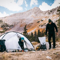
Both Jesse and Zach Pilgrim are born and raised Midcoast Mainers who have an innate drive to immerse themselves in the outdoors, and bikes have cemented themselves as core tenets of their philosophies about outside movement. Beyond the pleasure of riding them, they both spin wrenches as master mechanics at shops in Bath and Portland, too. But neither of them had ever bikepacked, and while they probably could have scrounged and borrowed enough gear for a multi-day trip, camping equipment presented the first hurdle to overcome.
I know The Pilgrim Brothers because I bought my house from their sister. You might say the house came with friends. Prior to working at Hyperlite Mountain Gear, I, too, built a life around bikes, having worked in the industry for 26 years. When Jesse asked if I wanted to get in the mix, not only did I enthusiastically accept the offer, but I also set about helping to fill the gaps in their kits. After all, part of my job at HMG is to find and share stories, and this certainly had the ingredients.
We just needed a place to roll, and the first thing that came to mind was The Katahdin 360 –a +/- 110-mile route devised by our friend Brian and published on the two-wheel travel treasure chest known as bikepacking.com. He wouldn't be able to join us, but he had priceless beta and was eager to dole it out.
The Katahdin 360 has only been attempted by a small handful of fellow bikepackers. Upon further investigation into the bits and pieces of semi-recent info we could string together, along with intel from Brian, a singular, fuzzily-defined crux continually re-emerged–a bushwhack of unknown distance and difficulty that was all but required if we wanted to close the loop.
The spoils of our proposed endeavor seemed trapped in a proverbial bramble-choked safe, and we needed a safecracker. If not someone who knew the combination, someone who had patience, resolve, and truly enjoyed spinning the dial on occasions such as these until something clicked.
 Joe Cruz is a legendary bikepacker with a multi-decade-long list of places he's explored and mapped for other adventurers on all the continents save Antarctica. Beyond his love for connecting dots by any means and by any order of magnitude, he also loves to do it aboard a fatbike, which worked out well since that was our non-negotiable in terms of vehicles for the miles ahead.
Our launch date coincided with free time between other trips he had on his docket, and it took all of five minutes for him to respond "Yes" to my text asking if he'd join us.
And just like that, Jesse's birthday wish turned into a seemingly feasible present that we just needed to unwrap.

DAY ONE
Mileage: 50
Elevation: 3176 ft
Terrain: Postcard rolling gravel park roads

A few months had passed since Jesse first uttered the suggestion for this journey, and we all did our due diligence in the meantime to get ready. As is always the case with a crew, we discussed the pros and cons of items to bring along, food to eat, and forecast what-ifs.
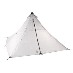
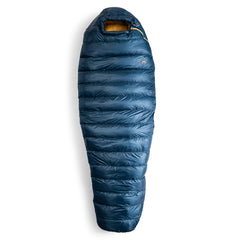
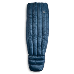
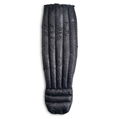
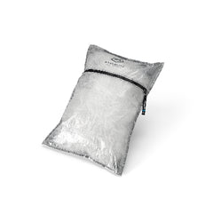
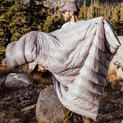
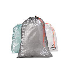
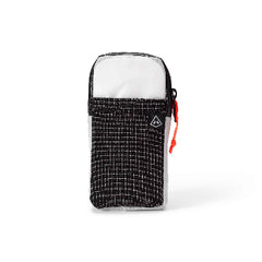
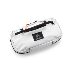
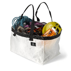
We settled on Mid 1's for tents as they're perfect for bikepacking, with one new prototype jobber from the R&D department to test. 40-Degree Quilts packed in Side Entry Pods would save space in our framebags and unfurl to knock us out when the moon rose. We'd put light stuff, water, and in Zach's case, a fishing pole, in Elevate 22 backpacks and organize other bits in Drawstring and Roll-Top Stuff Sacks. We filled in the rest with tried-and-true items that have earned their inclusion by way of other adventures and rolled up to the start with very confidence-inspiring setups.

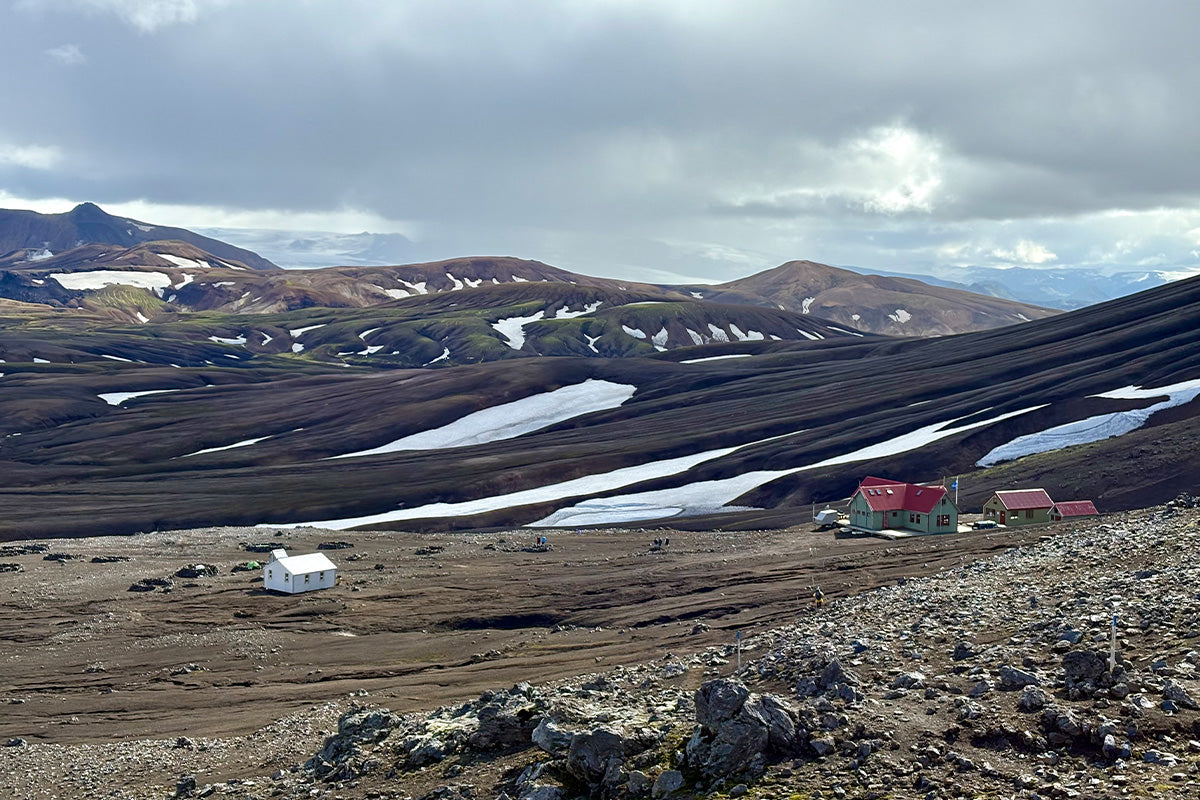
With the "all clear" given, we locked up the cars in a facilities parking lot at the Togue Pond Gate of Baxter State Park and set our plan in motion. Our big goal was to make it to the Matagamon Wilderness General Store for food and to install a few ice-cold bevvies before they closed.

As we rolled away feeling quite proud of ourselves for not only making it to the start but also because of just how pro everything looked and felt, the first long and steep rise in the route not-so-subtly reminded us that we were going to get what we were going to get in the days ahead. We climbed, got a little treat, and climbed again, over and over for the next few hours, and just when it would start to hurt our feelings a little bit, we'd be gifted views of the "Greatest Mountain"–Katahdin–the name bestowed by the indigenous Penobscot people who were in awe of it long before we were.


Day 1 was always about making miles, and we made 40 by the time we reached the campground at Trout Brook Farm. We found our site, set up our tents and got situated, shed bags from our bikes, and rode five more hilly miles to the store, making it with plenty of time to gleefully pelican burgers, pizza, and refreshments, grabbing a few brews for when we got back to our homes for the night.


The needle on the stoke-o-meter was buried in the red zone.
DAY TWO
Mileage: 30
Elevation: 2139 ft
Terrain: Fantasyland to Dante's Inferno
Tent zippers and hissing sleep pads signaled it was time to get a move on. Within short order, supernovas of gear expanded and contracted back into compact and manageable bundles on our bikes.

The temptation to retrace our tracks back to the Matagamon Wilderness General Store for breakfast was too strong and convenient to ignore, and after the initial full body shock that came from replanting our butts on our saddles, we pedaled back along the now familiar gravel to properly begin our day.
"Mawnin', Mahk" said Joe, the store owner, in his strong Maine accent, making me instantly feel at home in this place I'd just fallen in love with the night before. Magic motion potion filled our cups, pancakes and egg sammies vanished. Jesse's table-sized maps were laid out once again, and fingers pointed at tiny spots we'd soon see up close and personal.

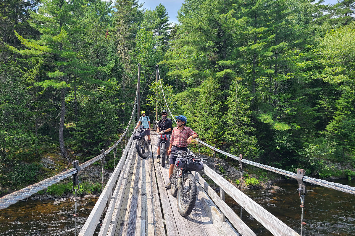
While the previous day granted us safer passage by way of well-maintained gravel, the new surfaces and widths of Day 2's tracks greeted us almost immediately. No complaints there as they validated our choice of tire sizes for this odyssey. Little did we know that a few hours from then, that validation would be cast in marble, memorialized for the future explorers like us whose curiosity about the Katahdin 360 would get the best of them. But we wanted to wander and snoop at whatever looked interesting out there, and very rarely do you ever have to cry uncle and turn around with a fatbike.

As the doubletrack was repeatedly halved and doubled again, we discovered sidecuts that took us to gorgeous river and waterfall lookouts, taking note of campsites that we vowed to post up in next time we headed north with our bikes–something by that point, we all knew was going to happen. There wasn't another soul around, and even if there were, they wouldn't have known we were there, either, so vast and dense are the forests of Baxter State Park and the Katahdin Woods and Waters National Monument. Pure bliss.


But nothing lasts forever, as they say. Like a clap of thunder in the distance, Jesse and Joe both commented that "This, I think, is where it's supposed to get burly." As we passed the edge of the Bowlin Camps property to find the section of the International Appalachian Trail we'd be following, you'd have had a hard time convincing me that the giggles I know I heard from the clusters of trees all around us were imagined.

The IAT looked less like a trail and more like a rumor.
For the next three hours, we dug in and gave it the onions, plowing our way through anything that found whatever space it could to grow and die. Fair bet the trail had not seen maintenance in years. Squinting ahead through the small, seemingly spring-loaded trees and brush that completely enveloped us, we aimed for whatever we thought might connect the last ribbon of Earth we saw to the next. I honestly could not believe we were still pedaling or that there weren't piles of mangled bike parts and gear in our wake. To say we were following anything was generous.

"So, this is the bushwhack we've been talking about for months, eh, Joe?" I can't tell you how much I was hoping he would respond, "Yes." Not a chance. "No. This is still the trail–the bushwhack is still a few miles ahead." I tried to imagine what could possibly be worse as we approached the definitely haunted Lunksoos Lean-To to collapse and sweep whatever calories we could into our mouths.

I've been to more punk rock shows in small basements than I can count, but the actual bushwhack was a mosh pit with no vanishing point. When handlebars weren't caught on trees, pedals were, and when pedals freed themselves, they spun right into the backs of our calves. The Pilgrim Brothers were undeterred. Jesse took the lead like a birthday boy possessed by wood goblins while Joe consulted his GPS, occasionally yelling "Trend right! Trend left!"
 Somewhere on the other side of this torqued-beyond-spec mess was a wide stream. I asked Joe how far away it was. "700 ft!" A half hour later, plastered with bug bites and scrapes with enough detritus covering my body to begin the composting process, I weakly mumbled the same question again. He responded with the same answer, "700 ft!"


When we finally emerged from the gnarled web of the energy-sapping hellscape, we stood on the banks of the Wassataquoik Stream, somehow only yards away from where we needed to be to cross it. Joe had cracked the safe. Peering across its width, there was nothing left to do but wheel our bikes through it to the other side. Thankfully, it never rose above our knees, and the surge of adrenaline that hit when we submerged our shredded legs was oddly reinvigorating. We waded across, refilled and filtered water, and made one more short push to a dirt road that took us to our supremely welcoming campsite and lean-to for the night.

Despite the thrashing, we were overjoyed by what we had accomplished. We cleaned up, set up, ate, and passed around Joe's flask of top-shelf Mezcal to celebrate and laugh about the awesome absurdity we blindly ventured into and overcame.
DAY THREE
Mileage: 25
Elevation:1959 ft
Terrain: Borderline merciful
A surprise downpour woke us all at midnight and continued for just over an hour. The Pilgrim Brothers were almost excited about it, as all the hype they'd heard about the hydrophobic wizardry of Dyneema fabrics proved true. We all shook the water off our tents, packed up our gear, and reloaded each item in its assigned spot on our bikes as if it were already second nature. We ate all but what we wanted left for later snacking en route to the end of our quest.

The distance ahead of us posed more questions about access and challenge, but at least we took comfort in our near-certain belief that there was no way we'd encounter anything like the day before. The roads, when we were on them, were scarcely traveled and rough, but the scenery made up for it with every passing mile. Mount Katahdin was always in view.


As we covered ground fueled by our newfound fortitude in ourselves and mad respect for our equipment, we let the omnipresent finality of our mission begin to intentionally slow us down. Like kids who go limp when it's time to leave a waterpark, I don't think anyone was quite ready for the trip to be done. We stopped at a beaver pond so Zach could throw a few casts at the small fish we could see going about their business just below the surface. We snapped a few more photos and set out pedaling our way up and over the final grass and rubble-covered hills between us and the Togue Pond Gate, where we'd parked our cars.

The hard fought for circle was complete, and Jesse, along with the rest of us, got far more than we bargained for out of his wish for a new biking experience on his birthday. Thank you, Jesse, for the great idea.
Jesse whipped up a video along the way for those of you who might be interested in tackling The Katahdin 360, including the specific route we took.