


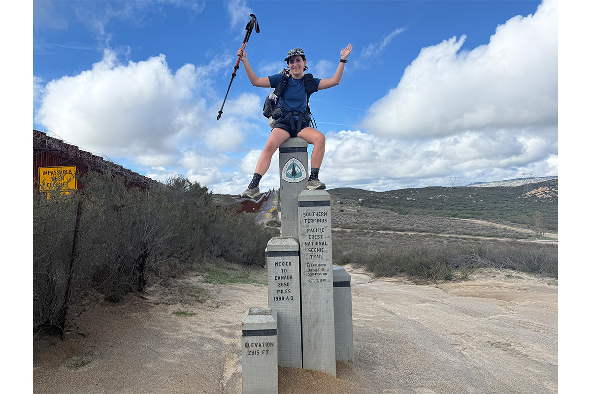
Words and Photos by Izzy Tonneson @izzytonneson
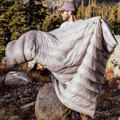
Planning a long thru hike is an exercise in irony. You can prepare for what’s coming, but you are also guaranteed that the trail will rewrite your preparations. I knew, even as I planned it, that the trail would make a fool of my spreadsheets.
For the CYTC, most people start in early March and follow a fairly standard sequence. First, the Appalachian Trail northbound, then PCT northbound, then CDT southbound, with slight variations. I wanted to start earlier in January to maximize time on trail across the year. Starting earlier gives me flexibility to take a zero if my body needs it and to avoid pushing through dangerous conditions just to stay on schedule. That decision raised a harder question about what can I realistically and safely hike in January and February, the heart of winter, without turning the experience into something unnecessarily hazardous or purely a suffer fest.
Out of that uncertainty came the need for structure. If I was going to start earlier than most and move through true winter conditions, I needed a route that was flexible and realistic about weather rather than ideal mileage. The plan had to balance building in margins for storms, injuries, and reroutes while still keeping forward momentum. What emerged was a working plan grounded in seasonal windows.

Plan A:
January: Begin on the Pacific Crest Trail, hiking the desert section, roughly 703 miles.
February: Transition to the Continental Divide Trail, covering roughly 650-700 miles through New Mexico.
Late February to early June: Shift east to hike the Appalachian Trail northbound.
June to late July: Return to the Pacific Crest Trail, heading north from Kennedy Meadows.
Early August to late October: Finish the season on the Continental Divide Trail, hiking southbound.
I began considering the desert sections of the PCT and CDT as a way to stay moving early in the year, but the decision was not straightforward. “Desert” is a misleading term for both trails’ southern miles, which climb quickly to high elevations. The San Jacinto section of the PCT just outside of Palm Desert, for instance, resembles a sketchy high alpine pass more than a desert and claims a few lives each year through slips and hypothermia. I wasn’t delusional about what this would entail. I knew I would be winter camping, checking the forecast daily, and moving deliberately. I never intended January and February to be high-mileage months, but even so, those early months still carve out a substantial foundation, roughly 1,400 miles toward the larger goal.
After that, the rest of the year looks far more familiar, closely tracking the traditional CYTC framework, with higher-mileage months timed around snowmelt and longer daylight. I also built contingency plans around seasonal irregularities, including sections I would simply skip and return to later in the year if conditions made them unreasonable to hike.
Plan B (high snow year in the Sierra Nevada):
If the Sierra has an exceptionally high snowpack, I’ll switch to a southbound PCT itinerary starting in June. This “snow-bo” approach begins at the Washington border and heads south to Kennedy Meadows, essentially flip-flopping the trail to avoid peak snow conditions in the Sierra.
Plan C (to avoid early-season snow in Colorado, should that be an issue):
On the PCT, I’ll hike northbound from Kennedy Meadows to Ashland (the California–Oregon border), skipping Oregon initially. I’ll then hike Washington before transitioning earlier to a southbound CDT, allowing me to complete Colorado in September rather than October. After finishing the CDT, I’ll return in October to complete the skipped Oregon section of the PCT.
My Plan A route became the scaffolding on which I built a massive pacing and resupply spreadsheet. On long trails, resupply usually falls into two camps. Some people buy all their food in advance and mail it ahead to themselves via USPS General Delivery, which allows post offices in trail towns to hold a box for up to thirty days before returning it to the sender. The other option is buying food in town, but depending on where you are, that can mean anything from a small grocery store to a single gas station.
I estimate that the CYTC will take me roughly 10 months to complete, which made it clear that the first approach– buying all my food upfront–wasn’t feasible. Instead, I opted for a hybrid system, mostly mailing myself resupply boxes, with a handful of in-town purchases mixed in.
Here comes, a glimpse of the Mega Spreadsheet:

The pacing and resupply spreadsheet became the backbone of my plan. It lists every trail town along the PCT, CDT, and AT, ordered to mirror my Plan A route in the exact sequence I expect to hike them. For each stretch between towns, I input a realistic daily mileage based on terrain and time of year, knowing my pace will change across seasons and trails. That turns vague distances into a specific number of days, which immediately determines how much food I need to carry. The spreadsheet also notes whether I plan to resupply in each town or pass through. I built in “zero days” so the plan does not rely on hiking nonstop. Those rest days shift downstream dates and resupply spacing. From there, the spreadsheet calculates food needs between resupplies and tells me exactly how much to pack or ship in each box.

Before leaving for the trail, I bought just over four months of food and packed the first month of resupply boxes. I wrote a number on each box that corresponds with a specific stop on my spreadsheet—box #3, for instance, is headed to Paradise Valley Café near Idyllwild, box #4 is headed to a hostel near HWY-10, etc. I gave my dad a separate document with instructions for managing the rest: how to pack each box, when to send it, and what qualifies as breakfast, lunch, dinner, and snacks. (Thank you, dad!)
What I did not anticipate was how much planning still remained once I worked with my dad to set the broad framework. For the first month, the desert section of the PCT, I got into the nitty gritty of where I might be camping, how reliable water sources are, and whether rides from trail angels will be available. This work is ongoing. I searched for trail angels willing to give rides to post offices in the off season and joined a web of “__ Town Trail Angels” Facebook groups to ask whether water caches were still being replenished throughout the desert. I cross referenced those answers with FarOut comments to identify dry sections.
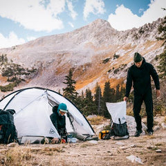
Pheeeewwww, that was a lot of logistics talk. Now for the fun part, hiking.