


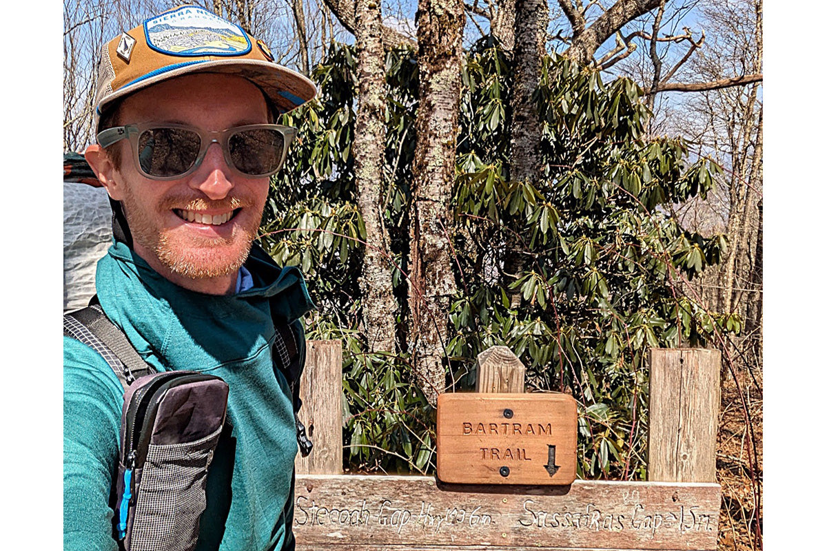
Words and Photos by Josh "Soulslosher" Sheets @soulslosher
LENGTH: 114 miles
WHEN TO HIKE: Spring, Summer, & Fall
WHY HIKE: Different views, healthy dose of solitude, well-maintained trail, opportunities to learn area history, and honors America's first native-born botanist (William Bartram)
HYPERLITE GEAR USED*:
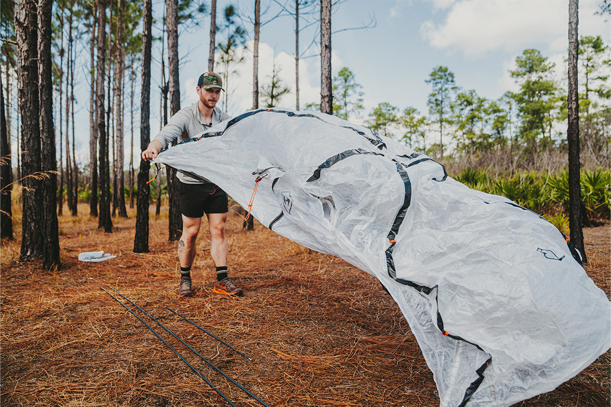
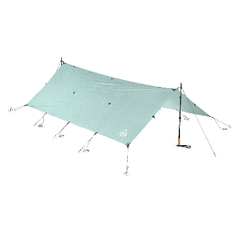
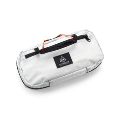
Very versatile, water resistant, can handle big food carries or extra gear with ease. I can just roll down the top when it's not in use!
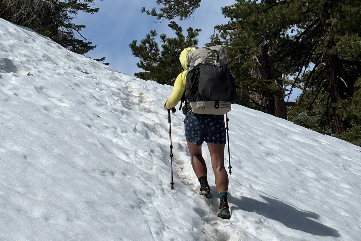
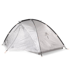
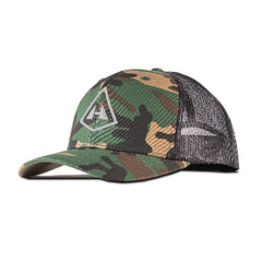
Perfect size and weight, requires only one trekking pole, mesh keeps the bugs out, and its compact footprint means it can fit in tight trail spaces!
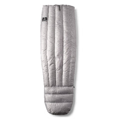
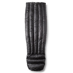
So LIGHT but so WARM! Packs down incredibly small. Oh, and it's SOFT!
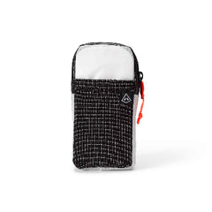
Super convenient; allows easy access to phone, lip balm, headphones, etc.
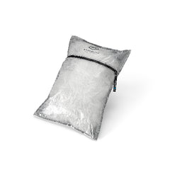
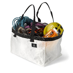
Pods and Stuff Sack Pillow and Fanny Pack [Versa]
Superior organization and additional water protection layer. I quite enjoy the stuff sack pillow because it mimics a real pillow once stuffed (vs. an inflatable pillow). A fanny pack is great for snacks when you're roaming around town or just so you can handily have your wallet, phone, glasses, etc.
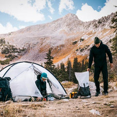
I find this gear kit hits the sweet spot for optimal balance of weight, comfort, and ease.
*If you have any questions regarding these gear items, how I use them, which would be a good choice for you, etc., please contact me! I'd love to answer any questions so you can make a well-informed purchase. IG and FB: “Soulslosher” or [email protected]

NOC TO CHEOAH BALD [VIA THE AT] TO BARTRAM TRAIL
If you had told me that I would ever take the Appalachian Trail for a stout eight miles to climb 3,500 feet out of the Nantahala Outdoor Center (NOC) just to get to another trail (the Bartram) so that I could thru hike it, I would have thought you were absolutely batty. But that's what I did! On March 28th, I left the NOC and briskly hiked past the still-fresh-faced and aspiring AT NOBOs on my way up to Cheoah Bald. From there, I picked up the Bartram Trail, turning south for my SOBO thru hike. Within a few miles, I had lost nearly all of the 3,500 gain I had climbed earlier that morning.
The trail follows the beautiful Ledbetter Creek, complete with aptly named Bartram Falls. The creek grows wider and louder the more you descend. With water everywhere, spring was on full display in this drainage. It was also in this drainage that I would meet Cosmo and Star Boy. We all three reveled in the fact that we had done the AT and PCT, quickly exchanging vaunted trail stories before we crisscrossed our separate ways. They would be the only other Bartram Trail thru hikers I would see.

BEECHERTOWN TO NANTAHALA LAKE
Once you're at the bottom of the valley, you cross the Nantahala River and Highway 19. I chucked to myself that if I hitched just a few miles to the north, I would be right back at the NOC. But if I wanted to skip miles and ride in a car, I wouldn't love backpacking as much as I do. Once across Highway 19, you follow the mellow Nantahala Bikeway through Beechertown (there is no town). Examples of old-time mountain life were prevalent through the trees in the valley. A towering stone chimney stood alone at a former homesite, and it's fairly awesome to realize that it was all done by hand and has literally stood the test of time.
Climbing out of the river basin, you ascend and descend several ridges and drainages before once again skirting the Nantahala River. This section was remote and wild with rhododendron and mountain laurel thickets along with some patches of Helene-related blowdowns and a prescribed burn. If I had planned better, I would have camped at the amenity-rich Appletree Camp instead of Widow-Maker Central at Piercy Creek, but that's just how it goes sometimes! There is some road walking while skirting Nantahala Lake, but I was lucky enough to stop at one of the marinas for a cold Coke. That can always make a road walk more tolerable!

NANTAHALA LAKE TO FRANKLIN, NC
Once you stop skirting the lake on Wayah Road, you very steadily climb until you reach Wine Spring Campsites along the AT. You'll ascend 2,500 feet in about five miles. After I arrived at the junction of the AT and Bartram, my solitude went away, and I was back in aspiring AT NOBO country. Yet, I appreciated this aspect of the Bartram. I could enjoy the AT in small pieces while still doing a totally separate trail. I pushed onward to Wayah Bald because I wanted a shot of a good view as the following day would bring heavy rain. I was in awe of the swirling clouds and the fact that I had the lookout tower to myself. I dropped down to the Wayah Bald Shelter along the AT to spend the night since camping is not allowed near the junction where the Bartram leaves the AT. In the morning, I packed up before the rain came. The trail would be a rollercoaster of general downhill all the way into Franklin. Stops at the very hospitable Outdoor '76 and Lazy Hiker Brewing were musts!

FRANKLIN, NC TO NC | GA STATELINE
Leaving Franklin on the Bartram is something of a choose-your-own-adventure. The Bartram is not on FarOut (yet!) and there are a few different roads to choose from. I had lost the yellow blazes for the Bartram somewhere in Franklin, and with Gaia helping me, I left town aiming for the Hickory Knoll Road Trailhead. This was absolutely my favorite part of the entire trail! I ascended into the Fishhawk Mountains, complete with Whiterock Mountain (a plutonic dome!), Jones Knob, and Scaly Mountain. The views in this section are quite exquisite. Additionally, the Bartram Trail Conservancy has placed various flora signs that detail trailside plants such as Dutchman's Pipe, Appalachian Club Moss, and Lily of the Valley. Lastly, I would be remiss if I didn't mention that this section also contains North Carolina's answer to the famed Fairbanks, AK bus. After taking more time to hike this section than I had planned, it was late evening by the time I made camp on an abandoned forest service roadbed close to the NC and GA Stateline.

STATELINE TO RUSSELL BRIDGE
I packed up and once again went over the plan for the day by triple-checking the map. In short, I had to make my own detour due to the Big Ridge Fire that had closed the Bartram Trail in Georgia from Stateline to Warwoman Dell. The plan was to walk various forest service roads until a small bushwack to gain access to Warwoman Road. This would keep me out of the closed area but still allow me to hike. I made excellent time due to the general downhill nature and nice roadbed treadway. I took a long break at Warwoman Dell, truly feeling like I was in a rainforest. History has it that Warwoman Dell was a Native American (Cherokee) dignitary who spoke on matters of peace and wartime, often deciding the fates of those who were captured.
Leaving "The Dell" I started climbing up Pine Ridge. It was easy to notice how the forest was different in Georgia vs. North Carolina. The infamous red clay soil and more shortleaf pines made for a more "open" forest experience vs. that of the rhodo thickets in NC. Additionally, with the lower elevations, wildflowers had popped up, and there was more greenery. The Bartram Trail's last hurrah is when it drops you to the free-flowing Wild and Scenic Chattooga River. Unfortunately, no banjo music and fortunately, no mishaps depicted in the film, Deliverance. But then, just like that, it's all over, quite unceremoniously, when you pop out of the woods at Russell Bridge. South Carolina can be seen just over the bridge.

SUMMARY
The Bartram Trail excels in a lot of ways. It is easily accessible, traverses some of the most rugged and beautiful areas of the southern Appalachians, and roughly follows the route that William Bartram took in the 1770s when he gathered information on flora and fauna and information on communities in this area. The trail is well maintained, well blazed, the popular and amenity-rich trail town of Franklin, NC is near the halfway point, and the trail offers a different take on this area over the ever-popular AT. Its length is perfect for a shakedown hike or a nice week in the woods filled with solitude. I don't really have anything bad to say about the Bartram other than I wish there were better termini signs and they had a program to acknowledge those that have hiked the whole thing (i.e. certificate/patch, 114-Miler Club, etc.).
BUT WAIT… THERE IS MORE
After finishing the Bartram, I linked up with some trail friends for a jaunt on the Chattooga River Trail. Our goal was to hike 25 miles in about two days while we skirted the river. We all donned our HMG packs–a beautiful 50/50 mix of black and white Dyneema. These packs have seen thousands of miles each–the one with the AT and PCT tags, well, you do the math!

The Chattooga River Trail section we were doing showcases this undammed and free-flowing river spectacularly. The Chattooga makes up the state borders of Georgia and South Carolina in this part of the country. Because you are down in a remote canyon for most of this hike, cell service was essentially nonexistent, adding to the wild feeling. We would soon learn that limited cell signal can also be a hindrance.
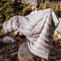
I had just finished my Bartram thru hike, so my legs were pumping like a well-oiled machine. Yet, it didn't matter because we were all getting overheated due to the record-setting warmth! We all opted to take a dip in the river during an extended lunch stop. For early April, the water was still quite cold, as you can probably feel from the scenic picture below.

Afterward, we slowly rolled out of our sandy shoreline lunch stop and ground up the trail. This part takes you up and over short but steep climbs away from the river. Our energy levels were wanning, but we decided to push onward. Soon, we encountered a mass of blowdowns like none of us had ever seen. No one could see where they ended and they were on a steep side-slope of trail. We tried to make our way through them and were only mildly successful until one of us took a bad fall off one of the blowdowns and landed several feet down from the trail, twisting a knee in the process.
After exchanging some wide-eyed glances and making a plan to double back to a dirt road, we started looking for cell signal on top of the rises. We were calling people who may be in the area to see if anyone could come to the Sandy Ford Trailhead for an extraction. The ever-present AT Trail Angel, Miss Janet, made her Chattooga River Trail debut, and we are forever thankful to her!

Once extracted, we graced the Clayton, GA Waffle House around 9:00 PM and unapologetically slammed about 2,000 calories each.
No Hyperlite packs were harmed during this failed Chattooga River Trail expedition.