Words by Dulkara Martig // Photos by Ben Weigl & Dulkara Martig
It was mid-August, and fall was fast approaching in Alaska. Locals were squeezing in their last summer trips before the winter set in. Bears were munching on the last of the berries. Bursts of orange, yellow, and red danced across the tundra, and fresh snow blanketed the mountain tops most mornings. Along with two good friends from Australia – Ben, and John – I set off into the Brooks Range in Arctic Alaska where we found spectacular granite spires, endless seas of boulders, and a surprisingly strong connection to that wild expanse.
From Fairbanks, we flew into Bettles where we loaded our gear into a float plane and flew one hour north, into the Gates of the Arctic National Park. Two bush plane pilots, clad in Xtra tuffs and jeans, waved us off with big grins and a sideways glance at me wearing a purple skirt. The humming of the Beaver faded into the distance, and we were left on the edge of Circle Lake. The boys cracked open a beer, and we sat in the tent feeling stoked to be in the Artic finally. There were no trails, roads, or any other infrastructure for over eight million acres. Bliss.
We planned to embark on what Roman Dial has called his “favorite ever” packrafting trip in Alaska, the Arctic Circle Route. We were prepared for remote, rugged off-trail hiking and scrambling with lots of boulder fields, combining two remote Arctic Rivers to make a great circular route.
On our first day hiking, we climbed over 3,000′ up a small mountain in light rain and low visibility. We were crossing into the Aiyagomahala valley with 11 days of food, and packrafting and hiking gear carefully stowed in our packs. Our loads felt anything but light! On our second day, we rock-hopped upstream in the rain, skirting around the river bank to avoid getting stuck in thick willows with a grizzly bear.
Thick mist obscured our views as we started heading towards Independence Pass where we’d be crossing the Continental Divide for the first time. This pass required us to cross the bottom of a small glacier before negotiating a precarious section of loose rock with bad fall lines. Ben commented as he spotted some poop,“If the Dall sheep can do it, so can we.” This quickly became the joke of the trip. Whenever we saw animal poop, even on the most treacherous ledge, we’d laugh and say, “We’re on the right track!” Hilarious, until you stumble upon small piles of Dall sheep bones in exposed places. It was a kind of madness: Ben and John were in their drysuits, we had huge backpacks, it was raining, and we were climbing big granite slabs to go packrafting!
Snow started to fall as we approached the top of Independence Pass. On the descent, we negotiated a massive field of boulders, some the size of small cars, and many covered in lethally slippery algae. Mist swirled in and out around the granite spires, momentarily giving us glimpses of the Kobuk Valley below. Later, it cleared properly, and we were able to enjoy the full view. We were in a granite fairyland with tall cliffs towering into the sky all around us. We had four more alpine passes to go over before we would reach the Upper Noatak River where we’d begin packrafting.
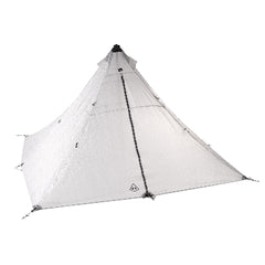
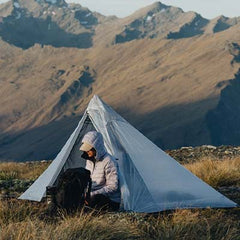
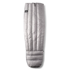
On the way up towards Deception Pass, the snow started to fall more heavily creating awkward and unpredictable conditions. We reached the top, but the route over the other side was treacherous. By this time, a small wound on my hand had become infected, I was feverish, and had pain tracking up to my shoulder. I stayed in a small cave just over the top of the pass while Ben and John went on a little reconnoitering mission to see if there was a route that would go. They returned empty-handed. The three of us huddled in the cave drenched to the bone, shivering and feeling somewhat demoralized. We half-heartedly chewed some pilot crackers and pondered our options. Our whole route was uncertain. Would we need to go down the Kobuk Valley until the river became packraftable? Would we have to retrace our steps back over Independence Pass? We sent a couple of Inreach messages to find out if the Kobuk River was runnable and what locations it might be possible to get a float plane pick-up. We returned to our previous night’s camp, set up our UltaMid, and crawled into our sleeping bags wearing every layer of clothing we had.
Determined not to give up, we decided to give Deception Pass another shot in slightly drier conditions the following day. We scouted a route down via some granite slabs and, with relief etched on our faces, made it to the valley floor. We were rewarded with the most fantastic afternoon of easy travel on the tundra. But we still had another three passes between us and where we could finally inflate the packrafts we’d been lugging around. Along with the decisions about the route, we were also constantly reassessing possible evacuation plans if the infection on my hand worsened.
The days started to blur together. We headed over Tallus Top Pass, Skinny Bou Pass, Mystery Spot Pass, as Roman Dial had named them. Our boulder-hopping turned into boulder hobbling. We were not, after all, as agile as the Dall sheep. Travel was sometimes slow.
By the time we crossed Mystery Spot Pass and descended into the Upper Noatak River, our bodies were weary and we were elated to inflate our packrafts for the first time. A couple of bouncier rapids merged into a cruisy, flat, and scenic float. We came round a corner to a bear on the edge of the river. He looked at us then continued washing in a small swimming hole. Our shoulders felt light and free as we effortlessly passed through open spaces. Tall granite spires gave way to scree slopes and rolling hills, becoming more mellow with each mile downstream.
Unfortunately, we had to make the heart-wrenching decision to fly out a few days early, as my infection had not responded to oral antibiotics and needed professional medical attention. We clambered into the plane waiting for us on an oxbow lake on the Noatak and were soon wistfully watching the rest of our intended route unfold beneath us.
When we got back to Bettles, the bush pilot who had dropped us in gave me some cheek: “I was wondering how you’d survive out there when we dropped you off in that purple skirt…”
The lodge was expensive, so we took up the pilot’s offer of sleeping in the hangar. Surrounded by wet gear and outdoor equipment sprawled out all over the floor, I drifted off to sleep on my half deflated packraft, clutching a map of the Brooks Range. I’d already begun to think about my next journey in Arctic Alaska.
Dulkara is one of our absolute favorite New Zealanders and is quickly establishing herself at the forefront of multi-sport expeditions and human-powered endeavors in the backcountry. From Nepal and Alaska to the deserts of Australia and Africa and the humid jungles of places like Borneo, she’s motivated to explore these places because “being immersed in the outdoors from a young age gave me an appreciation for the simple things in life and for the importance of staying connected to nature.”
For more updates and reports from her travels: check out Dulkara’s website (dulkaramartig.co.nz) and give her a follow on Facebook (@dulkaramartigadventure) and Instagram (@dulkara.martig).
The post Exploring the Gates of the Arctic via Packraft appeared first on Hyperlite Mountain Gear Blog.