


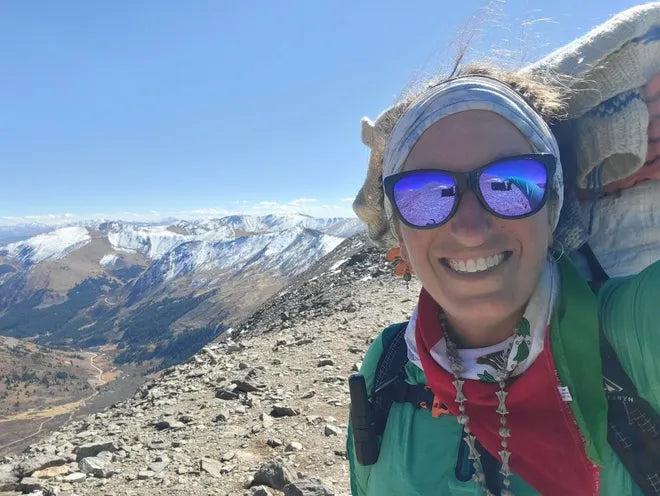
Words and Photos by Briana DeSanctis
For two years, Briana DeSanctis trekked across fifteen states following the 6,800-mile American Discovery Trail, becoming the first woman to do so in the process. She finished with a pack load of stories and experiences that we’re excited to share in future posts. But first up, should you want to embark on this journey yourself, make a mental note to watch out for these road walks!
What comes to mind when someone tells you there is a 6,800-mile long-distance trail in America spanning from coast to coast? You may envision a single-track trail winding through mountains, alpine lakes, forests and deserts. The American Discovery Trail (ADT) is sometimes that, but certainly not always. I hiked well over a thousand miles of paved roads on the ADT. In this piece I’d like to share what I thought were the three most dangerous road walks on the American Discovery Trail. I will explain why and share some survival tips. I had to pull screenshots from Google Maps for visuals, as it would be dangerous to pull out a phone while attempting to navigate these dicey areas. Included are links to tragic accident reports which have occurred along each segment to prove I’m not making this up.
ALWAYS WALK ON THE LEFT-HAND SIDE OF THE ROAD, TOWARD ONCOMING TRAFFIC
. HI-VIS CLOTHING IS ABSOLUTELY RECOMMENDED FOR THESE AREAS

#3: ROUND BOTTOM RD, OHIO*
Location: From the intersection of Olive Branch and Binning Road to after crossing the bridge of the East Fork of the Little Miami River
Danger Rating: 4/5 cones
Dangerous Miles: 5.80
Description: The heat begins immediately after some single-track trail followed by back road hiking. This is a treacherous, unshouldered secondary road on which the ADT takes the Buckeye Trail to Milton, then Cincinnati. Round Bottom Road is full of obstacles. This road is home to a branch of Heidelberg Materials, the largest producer of sand, crushed stone, and gravel in North America. Bzak Lanscaping & Garden Center and Redi Rok Structures also reside here. The companies’ heavy equipment, dump trucks and 18-wheelers take their toll on this otherwise country byway. They also pose a large risk to pedestrians. The road itself is despicable due to its heavy commercial usage. Not only is there no shoulder (in 2022), much of the road itself is broken off and long lost. The ditch on the side of the road can be steep, soft, and muddy.
Tips: Train tracks are active; don’t risk walking on them. In respect of the permissions of ADT hikers to use this trail, refrain from agitating train conductors (or anyone, for that matter). In wet conditions, expect feet to become saturated in the ditch while avoiding oncoming traffic.
Grandfather killed in Milford crash involving cement truck (wcpo.com)
Fatal Accident on Round Bottom Road (local12.com)
*GOOD NEWS: This road seems to have been repaired since 2022.

#2: SOUTH RIVER RD/RIVER RD, CALIFORNIA
Location: From the Freeport Bridge to Antioch
Danger Rating: 4.3/5 cones
Dangerous Miles: 51.74
Description: Here’s one that comes in like a lion and goes out like an even bigger lion. The greater Clarksburg region is a delta village of low-elevation vineyards dotted with lush vegetation, cottage-like houses beside elaborate mansions, fruit and palm trees, and the Sacramento River. The Freeport Bridge crosses the canal, and this alone is merely a small indication of the peril ahead. The shoulderless South River Road is lined with soft, squishy riverbank sand under decomposing leaves and small branches. The drop-off is steep and there are many sections of curvy guardrails lining tight corners. The traffic here completely disregards speed limits and safety. Many people live here so there is a lot of residential activity. The road snakes around with the river and many built-for-speed cars will pass on the double solid lines and even race each other. Every few miles or less, makeshift roadside memorials dot the ditches for those who have perished along this nail-biting passage. While there are false moments of security and a few breaks along the more rural territory, the final bridge into Antioch makes up for it.
This is the most unnerving bridge (in my opinion) on the entire ADT and accounts for bumping this from #3 to #2 on my list. It’s nearly two miles of sheer terror and 500 feet above the river at its highest point. This bridge is heavily trafficked (at least that’s how I felt at the time) with all different types of vehicles and the “shoulder” is only a few inches wide. It becomes slightly less frightening once you’ve gotten halfway across and the vehicles are now traveling uphill, becoming a little slower.
Tips: Plan accordingly. You might shit yourself at either end of this dangerous gauntlet. Do not cross either bridge during rush hours. Avoid walking this section at night.
CHP investigating Highway 160 fatal crash near Clarksburg in Sacramento County (msn.com)
Deadly crash near Clarksburg, Sacramento River kills driver | abc10.com
Antioch crash kills 1, leaves 3 children seriously injured (kron4.com)
5 dead in Sacramento County crash that was followed by a carjacking and pursuit, officials say (fox40.com)

#1: HWY 24, COLORADO
Location: From Cascade to the off-ramp at Manitou Springs
Danger Rating: 5/5 cones Danger Miles: 3.14
Description: If you don’t get whacked on this short stretch, you’ll at least cause an accident. This harrowing, three-mile death wish begins at the Pike’s Peak Popcorn Store, following a long teaser of frontage roads. This is the shortest stretch on the list, but it outranks the others in its scare factor. The official route of the trail takes you along the right-hand side (?!) of a two-lane highway. There are another two lanes moving in the opposite direction, but you have to cross all four lanes and a median to get there, and this is a full-blown highway. The speed limit here is questionable as nobody obeys it, and the grassy median exists only for a short time, making for a near futile respite.
Tips: My first advice here would be to call an Uber, but rideshare services are very sparse in this area, even with its proximity to Colorado Springs. Wear as much hi-vis clothing as possible to be visible to fast-moving traffic. Buy a bag of popcorn from the store and consume all of it while sitting on the front steps; it will likely be your last meal. Use this time to conjure up the good memories in your life. Scrutinize this stretch in advance; decide if it’s safer to play Frogger and cross the lanes. If you survive and make it to Manitou Springs, go find the 7 Springs. You have leveled up.
Colorado State Patrol identifies person killed on Highway 24 Thursday night (koaa.com)
Rollover crash shuts down westbound Highway 24 near Cascade | KRDO
Highway 24 closed in both directions at Cave of the Winds Rd. due to a crash (koaa.com)
6 trapped passengers rescued after crash on US HWY 24 | FOX21 News Colorado