


Words and Photos from Jessica Kelley
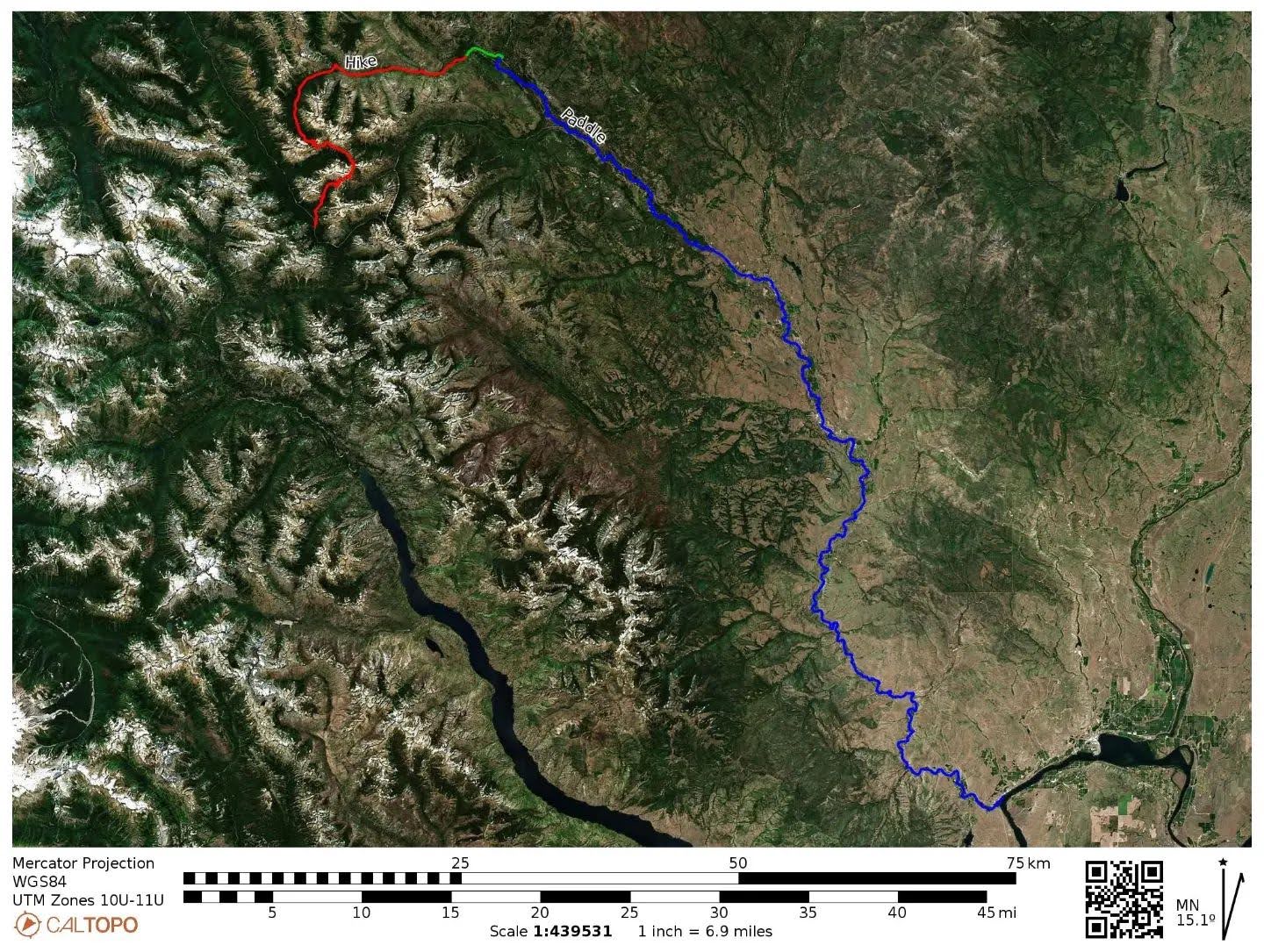
The Methow River starts deep in the North Cascades, a tiny rivulet near Methow Pass. As it trickles down past jagged peaks and through clouds of mosquitoes, it is labeled on maps as the "West Fork Methow," although an East Fork does not appear to exist. When it reaches the valley floor, it becomes the Methow River and winds through the Methow Valley, at times clogged with wood, other times calm and placid, and still other times full of big bouncy waves and class III+ whitewater. The Methow River ends at the Columbia River, over 100 miles from its starting point.
After living near the river for several years and spending many hours paddling the more popular stretches, I decided I wanted to experience the entire Methow River from source to C(olumbia). I liked the idea of watching the river change over time and space, much as it does through the seasons. In the same way that some folks summit peaks just to see what's up there, I wanted to trace the river just to see what's out there.
So, in the summer of 2022, I spent a little over three days following the Methow River from its source at Methow Pass down to where it ends at the Columbia River in Pateros. I traveled by foot (27 miles), by bike (3 miles), and by boat (78 miles). I finished the trip sore, scraped up, and wildly happy. It was an incredible journey and a great opportunity to become more familiar with the river valley that I call home.
DAY 0

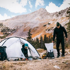
My husband Tom dropped me at the Rainy Pass trailhead at 630 pm on a warm summer evening. It had been brutally hot all day, so I was happy to see that it was only 75F at the trailhead. I knew it would just get cooler from there as the sun set, and I climbed into the alpine.
I saw a few thru hikers as I climbed up the Pacific Crest Trail, but once dusk settled in, I found myself alone on the trail. I kept my headlamp off as long as possible, hiking up and over rocky mountain passes in the dim evening light, stopping occasionally to stare at the craggy peaks still faintly visible on the horizon.
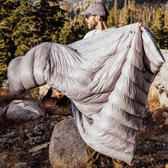
I hiked quickly to keep the bugs at bay but still arrived at Methow Pass after dark. I set up my tent under the milky way and two shooting stars and then fell asleep at the headwaters of the Methow River.
10.5 miles, 2400 ft of gain, on foot


DAY 1
I woke up to a beautiful sunrise and incredibly intense bugs (at least they weren't in tents? #momjokes). I improvised a head net with my hair, and it actually worked! After taking multiple photos of the sunrise, I crawled back into my tent for a short nap. At 9 am, I was awoken by the sun beating down on the tent walls, so I packed up quickly and started walking.

I got my first glimpse of the Baby Methow shortly thereafter–a tiny little creek tumbling down from the pass. I loved seeing where such a significant river starts its journey.

The day was characterized by heat and brush and bugs, but it was worth it to watch the Methow slowly grow from a rivulet to a river. The trail meandered through a recovering burn with no shade and multiple blowdowns. I trudged on, catching occasional glimpses of the river, which was too choked with burned logs to consider paddling just yet.
Eventually, I reached the end of the trail, and a few minutes later, Tom showed up with my bike and a cold drink. From here on out, he'd be meeting me each night in our truck camper. Luxury! I hopped on my bike and pedaled the final few miles toward camp, happy to be off my feet.


16.5 miles, 4000 ft of descent on foot
3 miles, 300 ft of descent, on bike
DAY 2
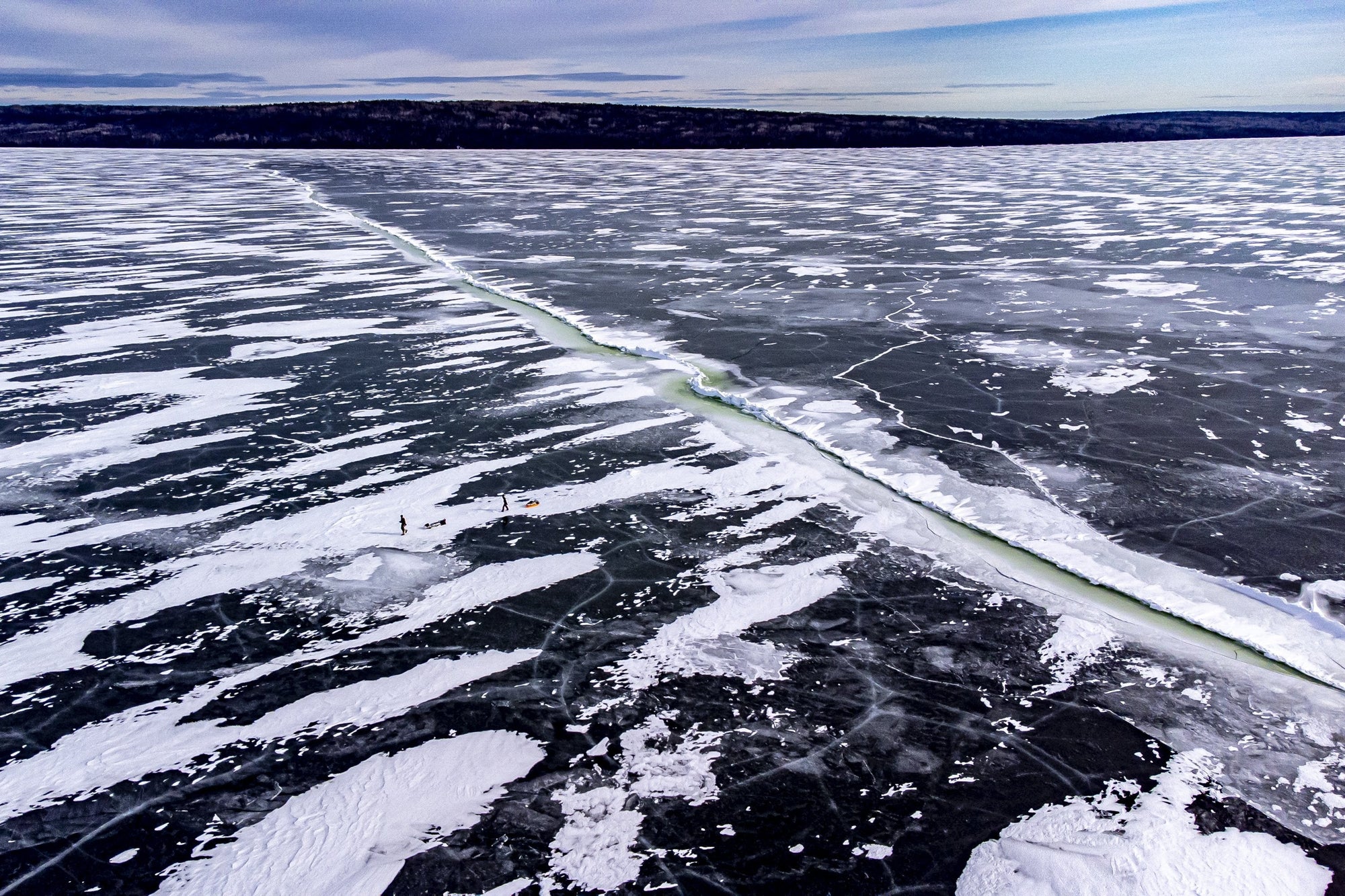
Time to start paddling! Sort of. The Upper Methow doesn't have any real rapids, but it does have lots of wood. Some folks call it "class I with class V consequences." The water was low enough that I felt comfortable doing this section alone, but I knew I still needed to be extra conservative. Low water slows things down, but any remaining current tends to push you right into strainers. This meant I was out of my boat every 5-10 min to portage around questionable logjams, plus multiple gravel bars that were just a little too shallow to float and required "walking the dog."

By Winthrop, there was less wood, more water, and way more people - at least a dozen folks in tubes, rafts, and SUPs. I was surprisingly happy for the company and found it energizing after a long day alone on the river–which was a strange feeling for this introvert. I paddled steadily as the sun started to drop and pulled into Twisp after almost 11 hrs. of boating, ready for dinner and some dry clothes.