


Words and Photos by Michael DeYoung
IG- @michaeldeyoung
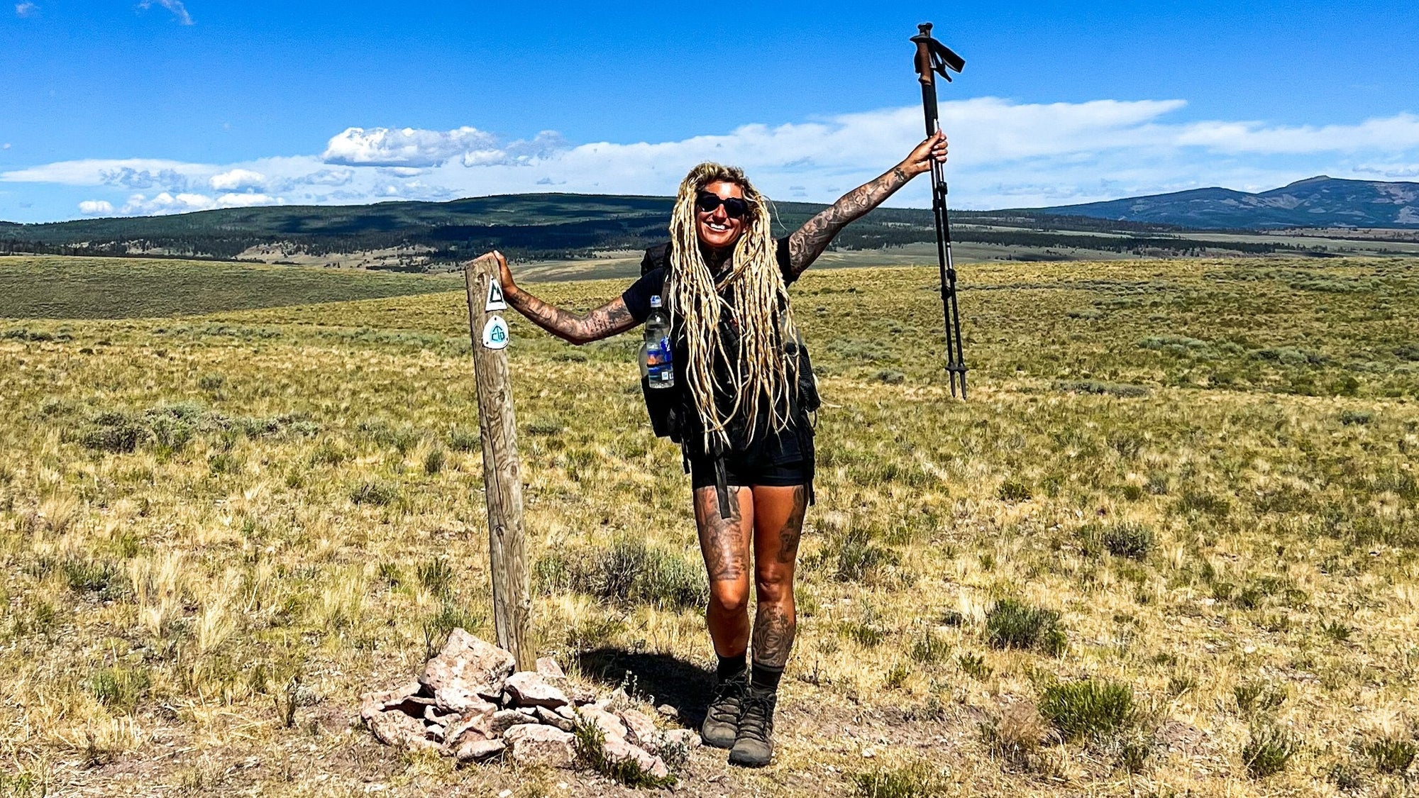
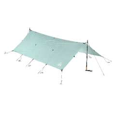
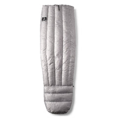
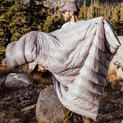
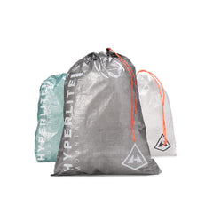
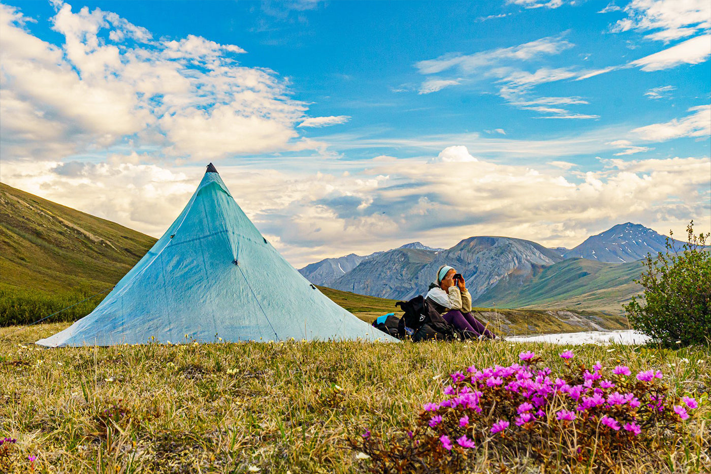
Lauri DeYoung scanning for caribou on a tundra bench above the Marsh Fork with Lapland rosebay and mountain avens in bloom. We chose an UltaMid 4 shelter with an UltaMId Half Insert for bug protection. That left us a very nice vestibule area to store our packs and pack rafting gear on layover days. Arctic winds even in summer can be brutal and snow can occur year round here. Only 4-season tents should be used in the Brooks Range.
In August of 1996, my wife, Lauri, and I flew 2.5 hours east of the windswept, arctic coastal village of Kotzebue, Alaska, in a chartered Cessna-206 on floats over a vast and unbroken chain of mountains. Crammed in the aircraft with us was a bulky 35-pound Pak canoe and 200 pounds of gear and food. The further we got from Kotzebue, the stronger the overwhelming feeling of insignificance became. The scale of the Brooks Range is hard to describe. Imagine flying the length of Utah, completely void of any human existence, with no roads, buildings, farms, etc. - just endless mountains and valleys. That pretty much describes the expanse of Brooks Range. This was our first really BIG solo adventure alone. Several years before, we had a challenging inaugural Noatak headwaters trip with friends from Anchorage. On that trip, record rains and early snow gave us our Alaska baptism–a two and a half-day delay in being picked up due to un-flyable weather.

The scale of the Brooks Range is so hard to capture in images. Flying east from the Dalton Highway, 80 miles south of the Arctic Coast, unspoiled mountain ranges, open tundra and river valleys go on forever.
We planned for a month of hiking and paddling on the Noatak River in Gates of the Arctic National Park and Noatak Preserve. We had no communications with the outside world. Satellite phones were really expensive and inReach technology was not around yet. (In retrospect, we should have rented a sat phone regardless of cost, even though we would never have needed it.) It was just the two of us with enough wilderness experience and whitewater canoeing skills to hopefully return in one piece. We were excited and anxious for this long adventure that took months to prepare for. Being a map junkie, I knew what we were getting into, but there was no way to prepare for the emotions experienced with the reality of extreme isolation.
When our pilot disappeared over the horizon after dropping us off on that warm and sunny day in early August, it hit us like a ton of bricks. Shit just got real. We were now past the point of no return with 375 miles of wilderness between us and our destination, the village of Noatak. Good judgment and skills guided us uneventfully through hundreds of miles of uninhabited wilderness. We finished in twenty-one days. Beyond the popular headwaters section, we felt as if we were the only people on Earth for two weeks, camping alone every night with no evidence of other human existence in sight. We saw musk oxs, moose, caribou, wolves, and red foxes. We encountered eight grizzlies on that trip, and they all ran away as soon as they saw us. Our biggest takeaway was learning that even store-bought bagels, full of preservatives and vacuum sealed, still molded after two weeks, leaving us breadless for the last week.
When you experience wilderness adventure of this magnitude, it never leaves you. In fact, it’s addictive, and the allure to return just grows stronger over time. Twenty-five years later, in 2021, we were back in the Brooks Range for our 5th trip, except this time with lighter, better, and more capable gear than we used in the 90’s. Pack rafts and innovations in ultralight backpacking gear have been game changers in exploring remote parts of Alaska, where many great places are only accessible by air taxi. The possibilities for combining backpacking and paddling trips into an all-in-one adventure are endless here. Weight is a huge factor in air taxi costs, and packrafts and ultralight gear (without sacrificing performance or safety) can equate to significant cost savings over traditional raft gear complete with coolers and foldable chairs.
 Marsh Fork Canning River, Alaska, Arctic National Wildlife Refuge, Brooks Range. Unloading for a seven-day pack raft trip at Grasser's Strip on a very warm (near 80F) late June day. From left to right: Dean Hoffer, Erich Hoffer (brothers both born in Anchorage) and pilot, Matt from Silvertip Aviation and a Cessna-185 on tundra tires. We were able to ferry seven people and ALL gear for a 10-day trip in three flights. Originally the pilot expected four flights but with ultralight performance gear today, our group saved nearly $3000 for not having an additional flight.
In late June, five friends joined Lauri and me for 7-days of packrafting and hiking on the Marsh Fork of the Canning River on the western end of the Arctic National Wildlife Refuge. We hoped to witness large numbers of caribou from the Porcupine Herd. The Marsh Fork was a last-minute change in venue. The original plan was to paddle the much more difficult class III Hulahula River, further east in the central part of the refuge. On our way up, we learned of a harrowing swim by an experienced and properly equipped pack rafter on the Kongakut River. With an exceptionally cold and wet spring, Aufeis was much more extensive and longer lasting than usual over many of the region’s rivers. Seasoned bush pilot recommendations to avoid the Hulahula were taken seriously. At the last minute, we opted for the less technical class II trip down the Marsh Fork. Fortunately, we had the opportunity to fly the entire section of river we planned to paddle on the way in. The Aufeis was extensive, but all channels were open on the Marsh Fork. Flexibility and adaptability are key to successful wilderness trips in the Brooks Range.

Lauri in a back channel going through Aufeis. Though the river was nothing more than class I in this section, there was still a strong current and Aufeis can cut offshore eddies. Fortunately, on our flight in we scouted the river and saw no obstructions from ice. However, Aufeis, which spanned across the mile-wide valley at times, can make finding the best channel tricky and challenging.
 Ann Silver scaling a nameless peak above a beautiful turquoise tributary to the Marsh Fork. On our 7-day trip we saw 2 other river parties but absolutely nobody hiking anywhere, as far as the eye can see. The ridge hiking in the Brooks Range is truly world class and on a good day the views are nothing short of epic.
The Philip Smith Mountains surrounding the Marsh Fork are stunning. Endless, easily accessible ridges beckoned to be hiked. With the time and expense it took to get here, it would’ve seemed like a waste if we had just blown down the 35 miles of river to our take-out in just a few days. Half the reason for being here was for hiking and taking the time to find large groups of caribou migrating south after calving season. We spent three nights at one location; it was just too beautiful to leave. Though this trip was the warmest and driest trip I’ve ever had in all of Alaska, the north side of the Brooks Range can unleash brutally uncomfortable conditions at any time during summer when northerly flow brings bone-chilling air and moisture from the Arctic Ocean. Better to have a few more layers and not need them vs. the other way around.
For the Marsh Fork, you don’t need expert whitewater skills, but you should have solid boat control. The biggest danger, especially in the early season, isn’t rapids or sweepers but Aufeis. This overflow ice lingers along the banks and sometimes all the way across the river, forming walls up to 10 feet tall. It’s really cool to see and explore, but it can essentially cut offshore eddies, rendering escape from an ice tunnel virtually impossible. The skills most needed are eddy turns and a solid ferry. These skills help you find the best channel and help you get off the river to scout downstream if necessary.
Don’t dismiss class II water as nothing to be concerned about. Swims happen, even on easy waters. Properly equipped boaters have died in class II water. Wise boaters don’t take unnecessary risks on wilderness rivers where help can be many hours away, even with effective satellite phone and inReach communication. Save the bravado for day runs. Arctic waters are deadly cold, and the golden rule is to dress for the water. Wetsuits don’t cut it here. This is drysuit country. Most Brooks Range rivers rise and fall fast, and a fun, splashy class II can turn into a powerful torrent overnight with pushy current and hidden hydraulics. Drysuits are a critical piece of safety gear and can actually save weight with your total clothing ensemble. Without one, a swim requires an immediate exit from the river and a complete change of clothes. A bundle of wet clothes can take days to dry here. With a properly functioning drysuit, a swim is usually no big deal, and underlying layers stay dry. We had several uneventful swims on this trip where there was no need to stop. Dry suits on the river are excellent protection from rain as well.

Wendy Sailors tackling some class II waves on our second day of paddling. Though we had mostly warm days (70's) the golden rule for boaters is to dress for the water, which is deadly cold. The Marsh Fork, normally clear turquoise blue was high when we ran due to hot weather sending a surge of snowmelt down from the headwaters.

The whole clan, sans me, in an eddy on another beautiful day in the arctic. All 7 of us wore waterproof/breathable drysuits with sewn in booties and relief zippers. Wetsuits are heavy and ineffective in water this cold. Drysuits add a layer of safety and comfort. Swims are possible, even in mellow whitewater. Lauri swam when she missed a hole while watching other paddlers and gawking at the scenery. No big deal. She did a great in-river self rescue and just continued paddling with no need to pull off, change clothes or start a fire to warm up.
The unusually warm days induced some pretty big thunderstorms usually seen further south in Interior Alaska. On our way back from a great ridge hike, a huge thunderstorm cell caught us off guard as we hurried back to camp over a mile away on a huge treeless alluvial fan where I was the tallest object around. I was alarmed at the frequency of lightning and thunder. It felt as if I were in the Colorado San Juan during monsoon season! There aren’t any verified lightning strike deaths in Alaska, but there is always a theoretical first, and I didn’t want to be that guy. Fortunately, we made it back to camp before the brunt of the rain unleashed its fury on our tents.

Another beautiful and hot ridge hike from our next to last camp on the Marsh Fork, only a mile upstream from the confluence with the Canning River.

Cooling off in a clear and cold nameless tributary on an 80 degree afternoon.
There are hundreds of thousands of caribou that roam wild and free, but seeing large herds is still unlikely because the Books is such a BIG place that even large groups of animals are dwarfed by the landscape. Timing is everything, and we just didn’t score with seeing a massive herd in migration. We saw several small groups with our largest sighting on the main Canning with about 30 animals crossing the river. At our take-out camp, a beautiful and curious white wolf appeared several times on the river bank above us before disappearing for good into the vast tundra. I don’t remember seeing any bears. Brooks Range tundra is a pretty poor habitat, and bear population density is pretty sparse, so it’s no surprise we didn’t see one. Wild tundra grizzlies are generally not a concern. It’s unfortunate that there are those that think the handful of extremely rare maulings represents widespread and ever-present danger from bears. Of all the things that could lead to a misadventure in the Alaska wilderness, a negative bear encounter is near the bottom.

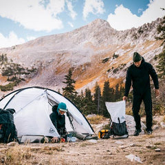
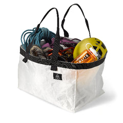
Our weather was nice enough to support an "open air" kitchen on the tundra for all of our meals. Following proper protocols for bear safety the group cooked at least 100 yards from camp and all food was stored in bear canisters which easily fit in the tubes of our pack rafts.

In five trips to the northern Brooks Range over the years, I've never seen a huge herd (hundreds or thousands of animals) of caribou migrating south after calving. Other boaters have been more fortunate seeing huge herds on their trips. This band, crossing the main Canning River was the largest group we encountered on this trip.
Alaska’s Brooks Range is the ultimate mountain wilderness in the US and it will humble you with its massive scale no matter how many times you go there. Stretching east to west and unbroken for nearly 700 miles across the northern third of mainland Alaska, only one road cuts north-south through the range–the Dalton Highway that parallels the pipeline from Prudhoe Bay southward. Within its vastly roadless and uninhabited ranges lie two national parks-Gates of the Arctic and Kobuk Valley. East of the Dalton is the Arctic National Wildlife Refuge, where the Marsh Fork lies. The treeless north slopes of these mountains are my favorite. There are probably a hundred or so navigable waterways in the Brooks. They allow me to combine all my passions