Words and Photos by Max Kiel
Fall is the best hiking season of the year. Just my opinion.
Don't get me wrong, I love being out there any time of the year, but that window from late September through mid-October here in New England offers prime conditions. Fall foliage, no bugs, cool temps–what is there not to love? Well, the trails can get extremely crowded at times. But the pros definitely outweigh the cons.
All Summer, I knew that I had wanted to plan a multi-day fastpack during the peak Fall season. The hardest part, though, was deciding what exactly it was that I wanted to do and what I was hoping to accomplish. I love planning out trips, and the planning and prep stages of adventures are always exciting for me.
The idea of hiking on the Long Trail ultimately won me over. I had about 116 miles left of the Northern half of the trail to complete it, and I was feeling inspired by my friend Nash, who thru hiked the LT just over a month ago.
My hike would commence at VT Rt. 15 outside of Johnson, VT, and conclude at the US Rt. 4 crossing outside of Rutland, VT. This is also where the Long Trail meets the Appalachian Trail.
I allocated myself five days for this 116-mile section. Ambitious? Yes. Doable? I believed so. I knew I would be riding that fine line of a physically and mentally tasking fastpacking effort, and an enjoyable, chill backpacking trip. Based on my personal experience, one does not move "fast" very easily on the Long Trail. Hiking long days and moving at a consistent pace would be the key to success.
I hoped to challenge and test my abilities as a mountain athlete, all the while immersing myself in the trail and the rugged mountains that would be my home for the next five days. I was doing this "unsupported style," carrying all five days' worth of food from the start with no stops in civilization. And, of course, I wanted to enjoy myself as much as possible!

Day One: Vt. Rt. 15 to Butler Lodge. 18.6 miles, 8,600' elevation gain
I'm not too sure why I dealt with so much anxiety as I was being shuttled up to the starting point of my hike. Maybe because it was going to be my longest multi-day effort since the John Muir Trail, which was well over a year ago at this point.
Was my body ready for this? What if the weather takes a turn for the worst? Do I have enough food? Did I lock my car back at the trailhead? Did I leave the bathroom light on in my apartment?
I knew that I would have to fully immerse myself in the task at hand and try to block out the outside world in order to get the most out of this trip. All that mattered was following white blazes on trees and rocks. It's quite simple, really.

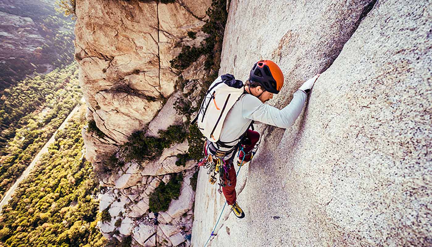
I slung my fully loaded Contour 35 over my shoulders, which carried everything I would need. After a relaxed, three-mile warmup, gradually climbing on a dirt road, the LT cuts into the woods and begins a steady climb towards Whiteface Mountain. The sunny skies that had greeted me at the start quickly turned dark and gloomy, as the wind gusts intensified. I could sense that precipitation was imminent.
Following the summit of Whiteface, the LT remains high on the ridge of the Green Mountains, meandering its way through steep and technical terrain towards Madonna Peak, which acts as the top of Smuggler's Notch Ski Resort. My body was still getting used to carrying a 20lb-ish pack, and I felt slower but solid on the steep climbs.
Mt Mansfield, Vermont's highest peak, sitting at over 4,300', loomed. It was a stout 2,000' climb over two miles to approach the treeline, but I didn't find the climb too tasking. Breaking treeline and scrambling my way up to the summit, a light snowfall had commenced. The snowfall quickly intensified, visibility was poor, and it was very cold. But thankfully, the winds were low.
I had the Mansfield ridge all to myself as I traversed and summited the other sub-peaks of the mountain, feeling like I was inside a snow globe on the very top of Vermont. It wasn't the idyllic bluebird skies you hope for with an alpine traverse, but this was the experience I was dealt, and all I could do was roll with the punches and enjoy the experience I was given.

Down climbing steep ladders and methodically shimmying my way through tight boulder squeezes, darkness began settling in. I soon stumbled upon Butler Lodge- a fully enclosed shelter with a porch, bunks, and a picnic table inside. It was just the caretaker and myself for the night, and we chatted about my planned itinerary as I warmed my soul with some rehydrated Pad Thai.

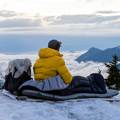
I was cozied up inside my 20-Degree Quilt by 7:30, mentally recapping the day. I was very happy to be out here, but I couldn't shake final thoughts of lingering doubt and anxiety as I drifted to sleep.
Could I keep this up for four more days?
Day Two: Butler Lodge to Bamforth Ridge Shelter- 21.19 miles, 6,591' elevation gain
The last thing I wanted to do was to get out of my quilt. I squinted towards the thermostat posted inside the lodge, which hovered just below 30 degrees F. It was right around 5:30 AM, and after forcing myself to get up, I began my morning routine of coffee, breakfast, and stretching.
On multi-day hikes like this, I try to stretch each night and each morning to optimize recovery and prevent injury. Horizontal and vertical leg swings right before hiking helped to activate my hips to prepare the body for another long day.
It was dark, misty, and cold as I made my way down off Mansfield. The descent was actually quite mellow, but visibility was poor with my headlamp. It felt like driving at night during a snowstorm with the high beams on–just take it slow and steady.
The sky gradually brightened as I dropped over 1,000' down to the valley floor. I love watching the trees transition from the Balsam Fir, Spruce, and Pine trees that can be found at higher elevations to the Beech, Birch, and Maple trees found down in the valleys.

The Long Trail hardly maintains a mellow grade for too long, and I soon found myself climbing steep hills again. A dense fog settled in as I climbed my way towards the summit of Bolton Mountain. The dark, damp forests, along with the dense layer of fog, paired with strong wind gusts, made for a very dark and eerie setting. There were no signs of any other hikers for hours.

Constantly eating and taking in calories are the keys to success for big days. I try to take in 250-300 calories per hour, all while on the move. This is easiest done with bars: Cliff bars, Lara bars, Snickers, and some other random granola bars I found at Walmart. This would be supplemented with other snacks, like trail mix, peanut M&Ms, and Dot's Pretzels.
A long, net-downhill ridge traverse follows Bolton Mountain, as the Long Trail slowly descends back down into the land of vibrant foliage. The temps hovered right around 40 degrees, the thick layer of fog was here to stay, and I contended with passing light rain showers. Fine by me. Give me these weather conditions over 80 degrees and 100% humidity any day.
Looking back, this day was by far the easiest I had on trail. It felt like more of a connector day, really, as the Long Trail makes its way South towards Camel's Hump, one of five 4,000' mountains in Vermont.
When the Long Trail is cruisy, you take advantage. I was loving the easy miles that remained, moving and grooving down the trail at a brisk 4MPH clip, as the Long Trail continues to descend at a very mellow grade, offering very minimal technicality.

All endurance athletes chase that "flow state"- it's hard to describe the feeling, but I like to describe this meditative state like a floating head, effortlessly making forward progress, feeling connected to the trail and the surrounding landscape, with your mind at ease.
Exiting the woods, followed by a three mile road/farm pasture walk, took me out of my trance and back to reality. Bamforth Ridge Shelter was the targeted destination for the night, which allowed me to break up the massive, six-mile 4,000' climb up to Camels Hump.

I arrived at the Shelter relatively early, around 5 PM, and was joined by a handful of Long Trail SoBo thru hikers who also wanted to call Bamforth Ridge Shelter home for the night.
Darkness quickly engulfed us as we chatted and swapped stories for a few hours before hiker midnight arrived (9 PM). I was thoroughly content cuddled up in my quilt and sleeping in a wooden structure in the mountains with strangers I had just met. Life was good.
Day Three: Bamforth Ridge Shelter to Battell Shelter- 23 miles, 10,075' elevation gain
I awoke right around 5 AM with my gameface on. My body felt fresh and my mind was primed to tackle what I knew would be the hardest day of this hike, taking on three more of Vermont's 4,000' peaks in the process.
I resumed the rolling climb towards the summit of Camel's Hump as the sun slowly crept up above the horizon. It was already warmer than the previous two days, and I actually had some views to enjoy while I climbed higher towards the summit, fully engulfed in a thick, dark layer of clouds.

Hitting the 4,000' elevation mark, the setting transitioned from Fall to Winter seemingly in the blink of an eye. The trees above 4,000' were entirely covered in snow and ice. Thankfully, the trail was not. Breaking treeline, I was greeted by 20-30mph sustained winds and very poor visibility.
If I wasn't fully awake yet, I sure was now. I dared not take my phone out to try to capture the moment. I put my head down and swiftly made my way up and over the summit before dipping back into the safety of the trees. The less than five minutes of exposure felt like a lifetime. What an adrenaline rush!
The descent off Camel's Hump was quite heinous, as I found myself coming across constant cliffed-out portions and steep rocky outcrops that forced me to chuck down my poles and downclimb to touch dirt again. This resumed all the way down to Wind Gap, where I stopped at the Montclair Glen Lodge to refill my water bottles and take in some much needed calories.
The Long Trail steeply climbs out of Wind Gap straight up to the summit of Mt Ethan Allen. I was in my element, moving well and feeling great as I descended the cruisy ridgeline, engulfed in a mossy green forest.

Technical and slow moving miles interrupted my groove as I approached Burnt Rock Mountain, with the trail being very reminiscent of what one might expect with the more rugged portions of the Mahoosuc Mountains in Western Maine.
Thankfully, the sun was finally coming out for the first time on the hike, and I was greeted by sweeping vistas from the vantage point. Day hikers were out and about, and would be for the remainder of the day, a stark contrast from the previous two days. It dawned on me for the first time that it was a holiday weekend, during peak fall foliage, on a beautiful weather day.

The trail winds its way down to the valley where I broke for lunch at the Birch Glen Lodge. Throughout the day, I typically stopped three times:
- One 5-10 minute break mid-morning
- One longer 15-20 minute lunch break mid-day
- A final 5-10-minute break in the latter part of the afternoon
I usually left each break feeling mentally and physically refreshed. I found that it helps to break up the day into manageable chunks rather than thinking about the total miles you may have to cover for the entirety of it.

A steep climb up to Molly Stark's balcony caught me by surprise, but the views looking back at Camel's Hump in the distance blew my mind. It looked impossibly far away from where I was standing.

Appalachian Gap was the busiest road crossing yet, and I was graciously offered free samples of Apple Cider. What a treat! I downed four cups of cider and made my way out of the gap back up onto the ridgeline, where I would remain for the rest of the day. I was feeling pretty worked at this point, but my climbing legs were firing today.
I was fully engaged and captivated by the beauty of this section of trail, which followed the ridgelines of Mad River Glen and Sugarbush Ski Resorts. The trail would occasionally pop out onto ski trails and the tops of chair lifts, offering sweeping vistas.


The remaining miles felt easy and quickly ticked by as I summited Mt Ellen and Mt Abraham, each offering more amazing views. The Adirondacks and Mt Marcy in New York were clearly visible from Mt Abraham as the sun began to set on the horizon. By far, it was a highlight of the adventure.


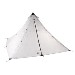
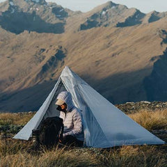
Descending down to camp, all I wanted was to get cozy in the lean to and have a quiet, relaxing evening. I even wondered if I would have the lean to all to myself. But, upon arriving, I was greeted by a group of 10+ University of Vermont students who had taken over the entire lean-to for themselves, who were not hesitant to bring the party vibes of Burlington out to the mountains. I pitched my UltaMid 1 Tarp nearby and fell asleep to the sound of hooting and hollering 18-year-olds, just as Mother Nature had intended.
Day Four: Battell Shelter to Sucker Brook Shelter- 22.6 miles, 7,077' elevation gain
My legs were definitely tight and my energy levels were running low to begin today's hike, as I descended over a mile down to Lincoln Gap. Rumor has it that the trail mellows out from here, as I was now leaving the high peaks of Vermont behind me.

This section of trail definitely felt easier, but the Long Trail is hardly ever "easy." I followed a cruisy, rolling ridgeline for several rather monotonous miles, making my way toward the Breadloaf Mountains. This section of trail felt very remote and could have used some maintenance, but it was flowy and enjoyable nonetheless. The next road crossing at Middlebury Gap wasn't for another 15 miles.

I found myself dealing with random swings of high energy, and getting close to bonking, and my legs were starting to feel pretty trashed. I was beginning to sense the end at this point, and for the first time of the hike, I allowed my mind to wander toward town food, a bed, and beer while traversing the scenic but rather uneventful Breadloaf Mountain range. The trail remained high on the ridge for several miles, with the occasional short but steep climb up unnamed peaks to keep things interesting.

The highlight of today's hike included lunch at Skylight Lodge, overlooking the idyllic Skylight Pond. It was another lovely bluebird fall day in the Green Mountains, with perfect hiking temperatures. As I shared this view with two other day hikers, they asked lots of questions about my hike thus far. I apologized for my stench, which likely caused them to not want to sit and chat for too long.
I flew down to Middlebury Gap to take one final break for the day. I was mentally treating these road crossing breaks like aid station stops during an ultramarathon. Except for the fact that I didn't have a crew to refill my water bottles and to load my pack with snacks for me, and no one to encourage me forward and tell me how great I was doing. What a shame.

Despite the five minute sit break, my legs felt like jelly as I climbed out of the gap and up the Middlebury Snow Bowl. From here I found myself counting down the remaining miles to camp. The strong winds the previous days had nearly blown almost all of the leaves off the trees, and I found myself "leaf skiing" with no sign of a dirt trail as I descended towards home for the evening. No one had claimed a spot yet in the lean-to, and no one else would show for the night.
At this point, the cumulative fatigue was really starting to catch up to me. A mild brain fog had settled in, my legs were cooked, and I could definitely feel the massive caloric deficit that was constantly growing.
I reviewed the components of my food bag, and rationed what I had left for tomorrow. I was stoked to discover that I was able to eat some leftover snacks right now with my dinner. It wasn't quite enough to satisfy the hunger, though. It never was. I slowly drifted to sleep with pizza on my mind.

Day Five: Sucker Brook Shelter to US Rt. 4- 24.8 miles, 5,958' elevation gain
I awoke at the standard time of 5 AM to a shivering body. Was it the coldest morning yet, or was my body struggling to maintain its body warmth due to depletion? Definitely the latter. This has happened to me before, and is nothing too concerning (I think?).
Filtering water, drinking coffee, and checking out the privy helped my body return to homeostasis. I had one more push in me. The Far Out navigation app indicated that I had close to 26 miles left to my car. I had done marathons plenty of times before, what was one more?
I left camp at 6 AM, guided by the fading light of my headlamp. It seemed that I forgot to charge it overnight. Oh well.
I was pleasantly surprised with how strong I was feeling to start the day, and made quick work of the morning's traverse of a series of unnamed peaks, contending with blowdowns along the way.
It was fully bright out by the time I descended down to Brandon Gap. The trail South provided some of the easiest miles yet, and I flew down this section of trail, looking to push myself. Despite being tired and feeling slightly burnt out, I wanted to practice keeping my mind focused and motivated during the tail end of an endurance effort.

It's easy to keep a positive mindset at the start of an endurance effort when you're feeling fresh and strong, but it is how you mentally approach the end of an effort–when the wheels start to fall off–that really matters. I put myself in a competitive, "race-like" mindset. Nothing other than relentless forward motion. I was determined to finish strong.
I moved nonstop for the next 10 miles or so before breaking for a brief stop halfway through the day. I pulled out my cell phone and recorded a little video update to look back on later, and I quickly noticed how baggy my eyes were and how exhausted I looked.
The terrain, for the most part, did not change for the remainder of the day. It was yet again another connector section as the trail cuts through a forested valley around rolling hills as it made its way towards Killington Peak.

There were no big climbs, but lots of steep mini rollers that killed any cruisy momentum to be had. It was death by a thousand paper cuts and was starting to get to me a bit. Dark clouds rolled in, and the skies opened up to a steady, cold rainfall.

Your thoughts control your reality. Read that again. My mindset gradually shifted from tough, motivated, and resilient to frustrated and feeling the overwhelming desire to want to be done. I made the mistake of thinking only about the end, which was still a decent chunk of miles away. I reminded myself that if I let myself have negative thoughts about the situation at hand, then, in return, it would make for a negative experience.
I forced myself to focus only on my breathing, a basic practice to be used in everyday life situations, not just on the trail. Deep breath, count to four, exhale, count to four. This was a tool in my arsenal I always tried to use in similar situations to allow myself to become present again.
The rainfall intensified, the temps dropped and the hills got steeper as I inched my way towards the "Maine Junction"–where the Long Trail and the Appalachian Trail meet. At this critical spot situated in a random location in the woods, the LT/AT continues South to Massachusetts, while the AT splits from the LT, headed Northeast towards Maine.
I could have opted to take the long way back home to Maine via the AT, and texted my boss to report that I wasn't going to be back to work for about two to three weeks. Ultimately, I didn't think that was a very responsible decision.
I stopped for a brief moment at the junction, which signified the end of the Long Trail for me. I celebrated the feat by taking a quick selfie at the sign as the rain poured down. I was happy about my achievement, but true stoke and contentment wouldn't fully settle in until I was warm and dry. After a brief one-mile descent, I popped out of the woods and saw my car waiting for me, exactly where I had left it five days prior.

The Inn at the Long Trail–a Long Trail staple–was a mile down the road. I stopped in for a Guinness and salad to commence the celebration before making the short drive to Rutland to spend the night. I was not in the mood to drive back to Portland at that time.
As I sit here writing this blog post, I can confidently say that the hike was a resounding success. Immersing yourself in a multi-day experience, one where you only have yourself you rely on and one that requires you to challenge yourself and step out of your comfort zone, will almost always lead to a positive outcome–no matter how difficult it may be during the moment.
I grew as an endurance athlete as a result of this hike, and I knew this feat was just another step towards much bigger and loftier goals that I am planning for myself in the near future.
I personally have a hard time settling on and feeling content with accomplishments, and I always look forward to what is next not too long afterward. But, for now, I think I'm quite content and am just about ready for the ski season.
Interested in a detailed breakdown of my gear list? Check that out here!
If you've called or emailed our Customer Service Department, there's a good chance you've talked to Max. When he's not out exploring everything each season has to offer, he's helping the adventure set get equipped for their own successes.

