Words and Photos by Max Kiel
I think it's safe to say that most hikers have their own "dream hike." That one on the bucket list we find ourselves daydreaming about while at the office. The one route that makes us pour over trip reports and constantly watch YouTube videos. The adventure that we swear that we'll go on someday soon.
In the early days of my hiking career, thru hiking the Appalachian Trail was that number one trail on my bucket list. After completing the AT, I knew I wanted to explore more of the country and experience different landscapes and environments. Places far different than what I was used to here on the East Coast.
I like to think that I'm pretty experienced when it comes to East Coast hiking. I'm grateful to call the beautifully rugged and technical trails of the Hudson Highlands, Shawanagunks, Catskills, and Adirondacks my 'backyard' playground.
I never get tired of the Beast Coast style of hiking, but I wanted to experience what hiking out West was all about. In my 23 years of life, I had never visited any of the Western states, let alone hiked above 10,000' before.
Everyone speaks so highly of the hiking opportunities in Colorado, so naturally, I chose the Rocky Mountains as the preferred destination for my first out-West hiking experience. After much research, Aspen's Maroon Bells Four Pass loop quickly became my new "dream hike."
I finally decided to stop armchair hiking it, hopped on a plane to Denver with my friend Jason, and took a drive out to Aspen's Maroon Bells-Snowmass Wilderness to experience this new landscape that has always seemed so foreign to me.
FACING THE ELEMENTS ON DAY 1 OF THE MAROON BELLS FOUR PASS LOOP HIKE
DAY ONE- 3.5 MILES, 2,031' ELEVATION GAIN

Dark, ominous clouds were rapidly forming in the sky, seemingly right on top of the sharp summits of the Maroon Bells. Maroon Peak and North Maroon Peak are known as '14ers' by Colorado natives, reaching heights of 14,163' above sea level. Referred to as the "Deadly Bells," summiting these two peaks is no easy feat and was certainly not on our itinerary for this trip.
It was around 1:30 p.m. in the Maroon Bells-Snowmass Wilderness area, roughly a 15-minute car ride from Aspen. My friend Jason and I–both sea-level dwellers living in New York–were about to embark on our 26-mile adventure through the heart of the Rockies. This route climbs over four alpine mountain passes, all sitting at an elevation of 12,400' above sea level while keeping hikers mostly above 10,000' the duration of the route.
We were slightly nervous but mostly stoked about the unknown that lay ahead. How would our bodies handle the elevation? Was this loop maybe a little ambitious for our first time hiking peaks that tall? Probably so, but off we went anyways, carrying everything we'd need for the next three days on our backs.
The trail instantly gains elevation at a very gradual rate on rocky but relatively cruisy singletrack. We made our way through several Aspen groves while constantly catching views of the Maroon Bells and surrounding peaks.
1.6 miles in, we reached the junction where hikers can begin the loop, either heading in the clockwise or counter-clockwise direction. We opted for the counter-clockwise route and headed up the trail to begin the ascent up Buckskin Pass, but not without a quick detour to Crater Lake first.

We tackled several switchbacks while making our way up well above 10,000'. I was feeling great so far, but I definitely noticed the thin air making this climb more physically demanding. It almost felt as if I were moving in slow motion at times.
We had aspirations of making it up and over Buckskin Pass, but we both knew that would all depend on the weather. Afternoon thunderstorms are the norm high up in these mountains during the summer, and we had no desire to find ourselves in the alpine zone, miles from the nearest tree, during a Rocky Mountain throwdown.
It was around 3:30, and the clouds really began to roll in. We could feel that a storm was imminent and quickly bailed on any plans of attempting a push above the treeline. We were just above 11,000' and decided we'd settle for the next campsite and tackle the rest of the pass first thing the following morning.
We had hopes of setting up camp before the weather really took a turn for the worst. We quickened our pace, but right on que, the loudest thunder I've maybe ever heard rattled my eardrums, followed by an intense downpour of hail.

We took shelter under the canopy of the trees, opting to wait a few minutes for the hail to lighten up before pushing on. It never did, and after about 10 minutes, we pushed on, gratefully stumbling upon some flat open sites nestled cozily in the comfort of tree cover.
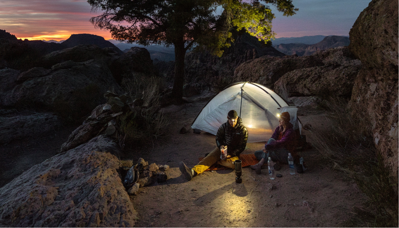
We found ourselves huddled under the tree cover yet again, hoping the hail would settle down before pitching our tents. The hail turned to heavy rain, and after waiting for what seemed like too long, the overwhelming desire for shelter and dry clothes overtook us, and we opted to pitch our tents in the midst of the heavy storm.
The storm raged on for hours, but it felt amazing being in warm, dry clothes and listening to the rain fall on the roof of my tent. The storm finally passed, and we were treated to dinner with a view of the Maroon Bells with the deep valley running just below. We had already seen so much, but the coming two days would blow our minds.

HIKING BUCKSKIN AND TRAIL RIDER PASSES ON COLORADO’S FOUR PASS LOOP
DAY TWO- 10.2 MILES HIKED, 2,894' ELEVATION GAIN
Eager to experience life above treeline at 12,000', we hurriedly broke down camp, scarfed down our breakfasts, and instantly resumed the series of switchbacks as we crept our way closer to Buckskin Pass at an elevation of 12,462'.
There wasn't a cloud in sight as we quickly left the trees behind us. We could clearly see our path winding its way to the top of the pass, with stunning views of the mountainous landscape surrounding us in all directions. I had high hopes for the views, and I was already having them exceeded.

We huffed and puffed our way to the top Buckskin Pass and admired the captivating 360-degree reward. We could see the upcoming mile or so of trail clearly laid out in front of us and watched as hikers began to make their way up the pass from far below, like ants marching up a massive hill, slowly but surely making progress.
The next couple miles were entirely in the alpine and fully exposed as we began the flowy, incredibly scenic descent down off the pass back into the valley below. We passed and chatted with several hikers on the way down, and all everyone could talk about was the intense storm the night prior. One hiker shared his story of attempting to crest the pass just as the storm rolled in and having to beeline it one mile to take cover in the trees. Oof.
We made our way back into the dense forest as the trail began to flatten out, and we soon found ourselves cruising through gentle, rolling terrain in the valley. We took the brief side trail to Snowmass Lake, one of the scenic highlights of the route, no doubt.

Rejuvenated from our break, we soon regained elevation as we began our climb up to Trail Rider Pass (12,415'). The trail up Trail Rider wasn't quite as steep as Buckskin, but it was an aerobic challenge, nonetheless.
We left the trees behind yet again and followed the switchbacks to the top of the pass, with Snowmass Lake sitting pretty far down below, getting smaller and smaller as we climbed higher. There were tons of other hikers admiring the view on top of the pass when we arrived, and the reason for this trail's popularity revealed itself.
We could've hung out up there all day, but it was around 1:00 p.m., and the clouds were beginning to look ominous again, and we knew that storms were well on their way. We began making our way down the steep, rocky set of switchbacks, making great time to ensure we would arrive back to the safety of the treeline before any storms arrived.

The descent seemed to go on forever, and we had our eyes set on some tent sites not much further ahead. We were really hoping to beat the rain to camp, but of course, to no avail. The storm came crashing down, and we hiked the remaining quarter mile or so soaked to the bone before finding a home for the night deep in the valley at 10,400'.
FRIGID AIR AND WEST MAROON PASS: THE FINAL CHALLENGE OF THE FOUR PASS LOOP
DAY THREE- 13.5 MILES HIKED, 3,284' ELEVATION GAIN
We were up early and hiking by 6:30 a.m., ready for yet another big day of tackling high-altitude mountain passes and battling afternoon thunderstorms.

The first two or three miles took us directly across the valley floor with very minimal elevation change, acting as a nice warm-up for the long ascent back up to 12,000' to the top of Frigid Air Pass (12,400').
The first set of switchbacks took us almost immediately to the top of the massive waterfall we had been approaching all morning, with a sweeping view of the valley we walked through just below.

In my opinion, Frigid Air Pass had to have been the most scenic pass of the entire loop. The moment we broke the treeline, we were greeted with massive fields of wildflowers, unlike anything I had witnessed before. The grade of the switchbacks to the top was rather mellow, and the best view yet was awaiting us at the top.
We hung out and snacked for a while in no rush to descend the pass, hanging out with other hikers. I was amazed how the people we met were so friendly and willing to chat out there.
The descent started off steep and rather technical before quickly leveling out. The next couple miles were my hands-down favorite of the entire route. The grade of the descent was so mellow it didn't even feel like we were descending–just gently traversing our way to the final pass. The trail never dipped back into the trees, so we were entranced with views the entire way.

Not a single rock was seen on this stretch of trail, and I was able to keep my head on a swivel oohing-and-ahhing without exerting much effort at all. This kind of hiking was far different from what I was used to back home. Yes, I'll say it; at times, it was much easier and more enjoyable.
I was simply blown away by the beauty and massive scale of these mountains, and I felt like I was walking in a dream; these words and photos simply cannot do it justice. Man, do I love it out there!
The final climb up West Maroon Pass (12,490') was the first climb that kicked my butt in these mountains. The grades seemed steep and rather relentless at times, and I was really feeling the elevation on this one, much more than on the other passes, dealing with a banger of a headache and uncontrolled breathing.

I finally crested the top of the pass, feeling drained and grateful the high-altitude climbing was now behind us. I enjoyed the stellar panoramic view and slammed four peanut butter tortilla wraps while watching Jason grind his way up to the top. Four mountain passes above 12,400'–not too shabby for two sea-level dwellers.
It was all downhill from here, as they say, and we put our legs in cruise control mode and flew down the enjoyably mellow but rather rocky descent back to the trailhead. We hiked past Crater Lake again and hung out for as long as the swarm of flies and mosquitoes would allow us before catching the shuttle back to Aspen.
I had high expectations for this route, and to say that I got what I came looking for would be an understatement. We were tired, cold, wet, and hungry at times, but that's the price you pay by opting to play in the mountains, and the Maroon Bells-Snowmass Wilderness is one incredible playground.

