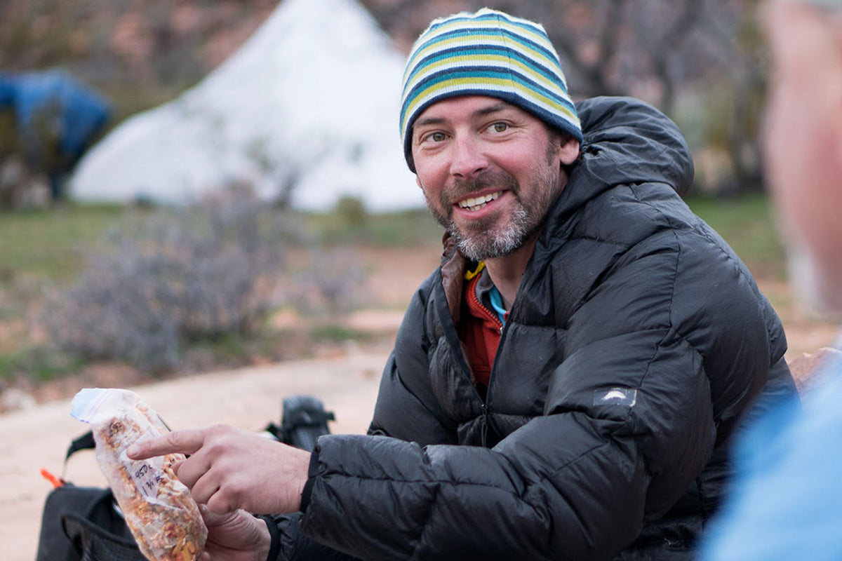


Words and Photos by Peter Bugg @plbugg
My sister says that if you do something more than once, you’re allowed to say you “always” do it. For example, after three consecutive years of springtime adventures, I can say, “I always go to Grand Canyon in April with my friends Andrew & Angela.” The past two years were very fun, with rappelling and a packraft river crossing in 2022, significant off-trail travel, and five miles of downriver packrafting in 2023. For 2024, our schedules were a bit more constrained, but lessons learned in past years allowed us to make the most of the time we had available. Additionally, our choices helped us avoid some hiccups that fellow travelers we met on the trail faced during their excursions.

On Friday, A&A woke up in Madison, WI, around 4:45a central time to catch a direct flight to Phoenix. I had the luxury of sleeping in until 6 am (8 central time) and finished packing before picking them up at baggage claim around 9:30 am. Their efficient packing allowed us to head straight to the South Rim, only stopping in Flagstaff to grab burritos for lunch. After a few final adjustments, we started hiking around 2:45 pm. The first leg of our itinerary was a stretch I had done before, but it was new territory for Angela & Andrew–6.5 miles down the New Hance trail, losing about 4,600 vertical feet along the way.
Temperatures at the top were in the high sixties, but every 1,000 feet in elevation loss gains 4 degrees Fahrenheit, so we anticipated inner-canyon highs in the high 80s. Luckily, our late start meant that much of our descent was shaded, and while downhill travel can be tough on joints, it requires less water and fewer calories. The first section of the New Hance is quite steep, dropping 3,800 feet in 4.25 miles, but our legs were fresh, the views were excellent, and catching up conversations helped the miles go by quickly, even as energy waned.

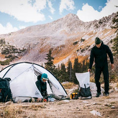
The high point was hearing rockfall 100 yards (?) off trail and looking up to spot a bighorn ram traveling across an escarpment. Their speed and nimbleness through scree fields and other sketchy terrain never cease to impress. As we continued down the canyon, the moon came up before the sun went down, and we made it into camp without the use of headlamps. We were tired enough that we elected to dine on bars instead of going through the rigamarole of setting up stoves and cleaning dishes, but my ego was fed knowing my friends had woken up in Wisconsin and were going to sleep next to the Colorado River.

On Saturday morning, per tradition, backcountry chef Andrew fired up the Jetboil and made us corned beef hash and freshly poached eggs for breakfast - lightweight packs, sleeping bags, and tents do allow for a few luxury consumables. As we were finishing up, a fellow backpacker popped into our site saying, “If you want to see something cool, my buddy is going to get airlifted out in about an hour.” The three of us practically did spit-takes, asking, “Is your friend OK? Do you need anything? Is there anything we can do to help?”
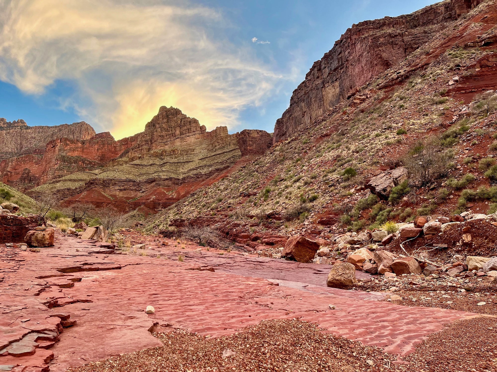
The interlocutor was quite nonchalant about it, responding, “He’s alright now…still not keeping solids down, but he’s been able to drink liquids and is feeling a lot better. He’s just out of shape and didn’t do his research. We’re going to have a good talk when we get out of here about how his decisions endangered other people.” Assured our neighbor was in good hands, we decided it would serve us best to beat the sun and get moving to avoid a similar fate, so we started heading west on the Tonto Trail around 8:30 am, climbing up and away from the river.

Our destination was nine miles and 2,700 feet of elevation away, and almost everything in between would be new terrain for me. Mileage-wise, it wasn’t going to be too challenging of a day, but it would require some attention to water. We wouldn’t find any water until six miles in, and our first reliable drinking source was at about seven and a half miles.
In addition, the forecast had predicted highs in the 80s to low 90s, and the reminder from our sitemates earlier that morning underscored the importance of making good decisions for the safety of the group. I am not a health professional, but I have spent a lot of time in the desert, and here are a few tips I’ve learned through my experiences:
●Even if you don’t feel hungry, it’s important to eat. Your body needs energy to help maintain your core temperature, and it requires more calories to keep you cool than to warm you up.
●Drinking cold water can help when it’s available, but wasn’t really going to be an option for us. Drinking warm water is still helpful for hydration, even if it doesn’t cool you down.
●Whenever possible, take breaks in the shade.
●Wetting sun hoodies to create evaporative cooling is a very simple and effective way to beat the heat. It’s especially worth noting that even when you encounter water you don’t want to drink, you can still use this option to help keep you safe and comfortable.
●This was my first experience using a parasol (fun fact: “para sol” translates from Spanish to “for sun”) which had been recommended to me by multiple friends. On the whole, it was lightweight, easy to pack, and helped keep me cool. One unexpected bonus is that while I was under the canopy, I was able to remove my hood which allowed more airflow around my head and ears.

Our first three miles on day two were pretty slow-going. Even though our two consumed meals had cut our pack weights, and the trail wasn’t as steep as the day before, we were gaining elevation and had quite a bit of water weighing down our packs. Luckily, miles four through six had a slight elevation loss, and went by much more quickly. We only came across two other people in this entire section–a pair of runners doing our same route as a day trip. I envied their minimal gear but was appreciative of the sunsets, sunrises, and glorious rest breaks provided by our slower itinerary.
We took quick water pauses every 15 minutes or so and slightly longer stops roughly every hour. Our best respite was in Hance Creek, shaded by Cottonwood trees, with our shoes off, feet in the water, and mouths full of snacks. After about an hour, we felt recharged and ready to climb 1,300 feet in two miles up to Horseshoe Mesa. Along the way, we stopped at Page Spring to camel up on water since we wouldn’t have another option to refill our hydration bladders before gaining the rim the next day.
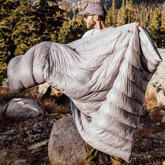
Our final push was a tiring but straightforward climb to where we took off shoes and set up camp around 4:30. The setting sun provided one of nature’s best light shows, which we enjoyed as we set up camp, cooked, and feasted on pasta with meat sauce. We were reminded of how the Grand Canyon got its name and were appreciative that our aging bodies are still able to keep up with our ambitions.

Saturday night’s higher elevation had cooler temps than Friday, which improved sleep and facilitated an early morning wake up. We enjoyed the sunrise from the edge of the Mesa, very close to the halfway point between the Colorado River and the canyon rim. After an efficient breakfast and packup, we got moving before 8 and made it to the rim in roughly three miles and two and a half hours. Along the way, we entertained ourselves by counting switchbacks in as many languages as we could remember–our high school French teacher, Madame K, would have been proud.

The low mileage and solid trail made for a straightforward day, but we did have one more interaction of note. About a mile from the top on a rest break, we were passed by a solo hiker. Trail Talk informed us that on her first day of Grand Canyon hiking the day before, she had walked 23 miles by herself without any Garmin or other SOS device. She was in Arizona for a work trip, and only had one night available to make the pilgrimage, so she decided to hike South Kaibab to Grandview, a 27+ mile route that most people would take two to three nights to complete.
Furthermore, in 2004 there was a fatality along this route when somebody tried to do this itinerary as a day trip in August. While I was impressed with her accomplishment, our conversation revealed that she had also experienced a few hours of mental darkness where she felt like she was 100 miles from anybody and wasn’t sure if she would make it to her destination. Everyone enjoys nature differently, and I have certainly made questionable decisions in my outdoorsing career, but a much safer (and likely more enjoyable) option for her would have been to do a lollipop variation around Horseshoe Mesa that would have had her sleeping in the same spot, but after only nine miles the first day. The hike out would have been the same as what she completed, and she only would have repeated three miles.
There are lots of Grand Canyon hiking resources, including a very helpful, active Facebook group, and I strongly encourage everyone to make good decisions with their outdoor recreation so they can continue to make a lifetime of memories with friends, both old and new.

All told, this trip was the least technical and aggressive route that Angela, Andrew, and I have completed together. But it was a perfect break from my daily life, and I feel very fortunate to have friends who appreciate this natural wonder as much as I do. I look forward to continuing the tradition in years to come. After all, it’s now something we always do.
NOTES ON GEAR
High temps meant we didn’t need much clothing. Here’s what I wore every day:
●Hat, sunglasses, sun hoody, shorts, undies, socks, trail runners.
I also packed the following:
●Sleeping undies, extra socks, windbreaker (not used), lightweight fleece (used, but didn’t need).
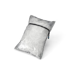
I did have a 7L water carry, which is almost 15.5 pounds, but I still don’t think my pack exceeded 30 pounds at any point, even though I brought too much food. A few key pieces of gear that helped me keep things light were:
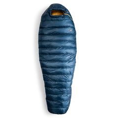
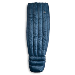
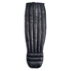
●HMG 40-degree quilt - 14.4 oz
●HMG Waypoint 35 pack - 23.5 oz
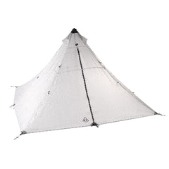
●HMG Mid 1 Tarp - 8.8 oz
●HMG Mid 1 Tarp Insert - 10.1 oz
●Therm-a-rest sleeping pad - 17 oz
●Ultralight Tent Stakes - 3 oz
TOTALS - 76.8 oz / 4.8 lbs / less than 2.2kg

One of the most exciting things about this trip is how far I think I could go with a very similar setup. In colder temps, I would need a few more clothes, and perhaps a 20-degree quilt, but would almost certainly drink less water. In familiar territory, I think I could get five to six nights with only minor adjustments in addition to more calories, which opens up a lot of possibilities. Stoked to see my dialing, tuning, and honing paying off. Now I just need to get the time off work…