Words & Photos by Matt "Chili Mac" Morelli
Dirty, cut, beaten, soaked; and that is just how my pack looked.
The crew and I had been pioneering the Greater Yellowstone Traverse for nearly a month by the time we stumbled out of the Gros Ventre Range and in to Pinedale, Wyoming. My legs had been shredded in a multi-day bushwhack in the Beartooth Range, my patience tested with clouds of mosquitoes through Yellowstone, my body crippled in the Tetons due to heat stroke, and now the Wind River Range was about to teach me another lesson or two. By the time the crew and I walked into the Great Divide Basin, my pack looked every bit as beat up as I felt.
Hearing my more experienced hiking compadres talk about the Winds for the last month made me feel like a little kid hearing about war stories or about the Cowboys and Indians on a wild frontier. I would usually listen intently, trying to imagine massive walls of rock still being scoured by glaciers to this day. Those glaciers then feeding into pristine alpine lakes teaming with tens of thousands of trout. Paradise, I had rightly assumed. Unless you have been to the Wind River Range, you are probably going to have to use your imagination as you read this. That is a good start, but know that as hard as I may try, I will never be successful in correctly portraying those mountains of majesty.
The plan for the GYT was to show off the highlights of the Greater Yellowstone Ecosystem, and it had done an exceptional job at achieving that so far. Connecting the GYT to a variation of the Wind River High Route is what is really the highlight of this trip. This 90-mile section of on and off trail travel has some of the most spectacular and challenging backpacking in the world. There are times where goat trails, and even some legitimate trails, wind their way through the patchwork of glacially carved valleys. It wasn’t through these stunning open spaces of relatively speedy foot travel that my pack got so beat up. No, this tale is about the North Winds, the most glaciated area in the American Rockies.

We entered the Winds along the Continental Divide Trail through Green River Lakes. Days earlier, the crew was trying to get into town, and the only way to do so was on a road on the other side of the Green River. Faced with the option of hiking six miles up the river to a jeep crossing or inflating our air mattresses and hoping to swim it, we naturally chose to swim. The four of us made it into town mostly before some rainstorms rolled in. Later the next day we met up with some friends during a zero day (zero miles walked) and now with seven members in our ragtag group, we camped out at the base of the climb marking the beginning of the WRHR the following night.
The climb off of the CDT into Knapsack Col was long, and the resupply was heavy on my back, but I damn near floated up it in a mix of excitement and anxiety over what was likely to transpire in the coming days. Stands of hardy pines were replacing open valley fields that we had hiked through the day before. Eventually, even their roots could not penetrate the increasingly dense piles of boulders. Now, above 10,000 feet, semi-permanent snow began to cover the boulders and snow fields salted the rim of Knapsack. It was nearly August at this point, and I was doubting much of that snow would ever disappear.
About four hundred vertical feet from the top of the Col, the clouds grew a few shades darker than just minutes before. The others and I decided to race the storms up and over the rim before glissading the massive snowfield down into Titcomb Basin. We posted up in a small cave created by a massive boulder sitting on several others, and the others came streaming in. Like clockwork, it began to hail and thunder around us. Safe, warm, and dry; it was smiles as we relaxed in our makeshift shelter. Hiding in these rock dwellings was quickly becoming a common practice on this trip, for this was at least the third rock I had to dive under so far. We decided the clouds were not going to let up any time soon, and we felt confident in the dwindling thunder, so we set out once more. Hours later, I found myself subterranean once again, riding out another storm.

Between the storms, we did what we could to make up time. We had planned for five, maybe six days to cover the 70-mile section down to Big Sandy which would take us to our last resupply of the GYT, so it was important to keep a decent pace. That being said, a man in a local fly-fishing shop spoke of an alpine lake teaming with the much sought-after Golden Trout, and upon reaching it we promptly dropped packs, fished with Tenkara rods, and basked in the pockets of sun. While some fished, others napped, but we all tried to keep an eye on the ever building and degrading procession of clouds. Finally, the clouds seemed to hit an apex when a deep rolling boom alerted us that we had overstayed our welcome, and so, we decided to make a hasty retreat.
We hadn’t even made it back to the trail from our fishing hole before I was already scouting for a new boulder den to dive into. I felt like someone preparing for an oncoming battle. “Maybe we could hide someone under there, two people under that rock, and set up a tarp amongst those stout pines,” I’d thought to myself. A light hail set in and we quickly fragmented to duck under any substantial shelter. On and off for the next half hour, the clouds would spit at us and broadcast bellowing rumblings of thunder up the granite halls. We finally decided we had enough of waiting and started to stream out of our hiding places, quickly trying to drop in elevation.
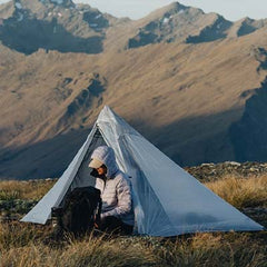
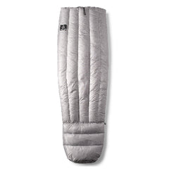
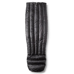
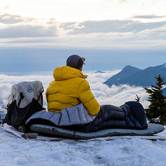
Soon, the storm was miles away and dissipating quickly. The crew and I all came strolling into a wonderful campsite tucked into to natural dimples in the land left by retreating glaciers. Tents and tarps sprang up all around, and we dove in as we were concerned for an imminent shower. The clouds slowly began to part, people poked heads out at first, then ventured out with quilts in tow. A pleasantly soft sunset radiated in the lower stretches of the sky in the west, and the temperature swiftly dropped with the sun. We all had clustered together on boulders and fired up our stoves if we had them. The smell of ramen and instant mashed potatoes stirred in the soft movement of mountain air. Waterboy (Tyler Cosgrove) informed us that he was not going to be able to go on with us the next day. His achilles had been bothering him for weeks now, and the intense boulder hopping of the WRHR was wearing them down too much. A side trail would take him to a road where he could hitch into town to get Sonic’s (Danielle Vilaplana) truck and meet us on the other end. We were all sad to see him get off trail, but it was definitely for the best. The last of the light was dying in the west. To the east, a deep notch in the mountains gave us a perfect view of a rising full moon.
The morning I awoke to was electric and crisp. We had figured the day was going to be intense, but we weren’t exactly sure of what was going to go down. We said our goodbyes to Waterboy as he headed down the valley and out of the mountains. The six of us that remained headed in the opposite direction, uphill to Indian Pass. The climb was relatively easy, but the real treat was on the other side of the pass. The ever-changing landscape of Knife Point Glacier extended out before us and touched every edge of this bowl in the mountains. After a small glissade down to a more level point to traverse the glacier, those of us with microspikes blazed the way while those with Yaktrax or no additional traction followed the footsteps with precision. Ice axes in hand, we made our way across the significantly slanted surface, making frequent stops to view the still mostly frozen lake a few hundred feet below. After a mile plus traverse, we had reached the bottom of Alpine Pass and began to ascend it.
We crested the pass and inched our way down a precarious boulder problem before getting the opportunity to glissade. I was the first to the start of the glissade and carefully got in place. A deep breath in, a small jump to swing the feet out, a cushioned thud of ass on snow, and I was off. For well over a minute I whooped and hollered in joy and excitement as I careened to the bottom of this immense snowfield, hands in the air like I was on a roller coaster. By the time the grade ran flat enough to stop my slide, I could feel nothing between my knees and hips, frozen to numbness by the snow. One by one we all made the thrilling decent until it was my good friend Moses’s turn.
A tall, wiry kid from Michigan who had an understandable fondness for hiking in very short shorts, Moses squared himself up and dropped on to the crusted snow. I’m sure he experienced many similar sensations that I did. The air rushing past him as he descended, the intense caution for exposed rock, and, most importantly, the quick freezing of the butt cheeks. By the time he had descended the 700+ foot vertical descent, my dear friend had lost most of the skin on the back of his upper thighs and ass, leaving faint blood streaks in the icy snow. I will spare you all those images and any more detailed descriptions.
Unfortunately, Moses’s ass wasn’t the only casualty of the glissade. Upon reaching the bottom and getting the rest of the crew down off the snowfield, we took a break and surveyed the damage. My pack, a Windrider 3400 which I had leaned back on to use as a break during the glissade, now had a hole in the outside mesh. The exact spot I had a titanium cold soak jar and a tripod secured had been worn down to the point of making it fray on the unnecessarily stressed edge. I had considered a field repair, but at that time I decided the holes weren’t enough of a concern to put forth that minimal effort.
It was well past noon by the time we took steps on solid ground coming off Alpine Pass. We had made it nearly four miles and had done two passes, a glacial traverse, and miles of hopping from boulders the size of refrigerators to those the size of houses. We averaged well below a mile an hour during the slog and even faint goat trails felt like superhighways to us. By the time that day had come to a close, we had only traveled 14 miles during 13 hours of hiking. We came into camp nearly limping and exhausted, but we were far from the end of the Wind River High Route.
The next couple of days were filled with misadventures and exuberance alike. Moses and I ran out of food a ways shy of the goal, and we were kept mostly functional thanks to our buddy Cheese Beard’s Tenkara fishing rod and an abundance of brook trout. Sticks, another hiking friend, would get separated from us twice, and storms would continue to thwart our advances through the impervious Wind River Range. Moses never once complained about his raw injury and even joked about it. A fiery sunset over glacial lakes put us to sleep one night, and storms kept us at bay for hours the next morning. A soft perfume of wildflowers the likes of which I’ve never seen before floated through the same air we saw a base jumper plummet through before his parachute opened. Everything was both beautiful and brutal out there.

All of us were tired, hungry, beat up, filthy, and overwhelmingly happy. We saw few people for days at a time, and as a result, relied deeply on one another and our gear. My Windrider did sustain some damage, but after the trail I got it patched up and sent back, and it is now good as new. Had it not been for my improper packing of the outside mesh, I likely would have never got a hole in the mesh at all. By the time my pack made it to this point, it had been through many, many miles of thick bushwhacks and wild terrain. Even with its failure, I still prefer the mesh due to its weight savings and easiness to access gear in the pocket. I cannot wait for the next adventure with my beloved and embattled backpack.
For another point of view on the Wind River High Route, please see Josh Tippett’s (Cheesebeard) instagram page @cheesebeard_hikes for day to day items, and Jackson Kramer’s (Sticks) Youtube page Jackson Kramer for videos of our progress. Other sources of content, inspiration, and companionship are @clayhikes, @tylercosgrove92, and @oc_boyd

