Words & Photos by Mike Curiak
A bikepack and packraft traverse of Alaska’s Lost Coast between Cordova and Icy Bay, using inspiration from those whom came before.
175 miles in 7 days, though the numbers are still irrelevant. I mention them only to provide some context — a framework if you will — to understood what we did in Alaska. I doubt I can explain why to anyone that doesn’t already get it. Highlights included dense fog on the Copper River and its delta, massive swells buoying us along on the crossing of Icy Bay, brief moments of sun (or at least not-rain) amidst all the rain, thousands of seals, mirrorlike beaches near Katalla, millions of berries, and the camaraderie developed between friends attempting a challenging and worthy bikepack and packraft objective on Alaska’s Lost Coast.
Day One:
Late night flights are part and parcel of any trip to Alaska, ensuring that you’re at least a bit rummy if not downright discombobulated before you even have feet on the ground. In 20 years of annual sojourns north, my antidote to being off my game from square one has been a lot of OCD prep before leaving home. Upon landing I typically only need to unbox my bikepacking rig, devote 5 minutes to threading pedals in and bars on, then consult my shopping list and spend 10 minutes grabbing essentials from Freddie’s before I’m ‘ready.’ This year I had the benefit of arriving half a day before Jaybs and Brett, giving me bonus time to fiddle with gear, catch a luxuriant catnap, and then re-check all the fine details.
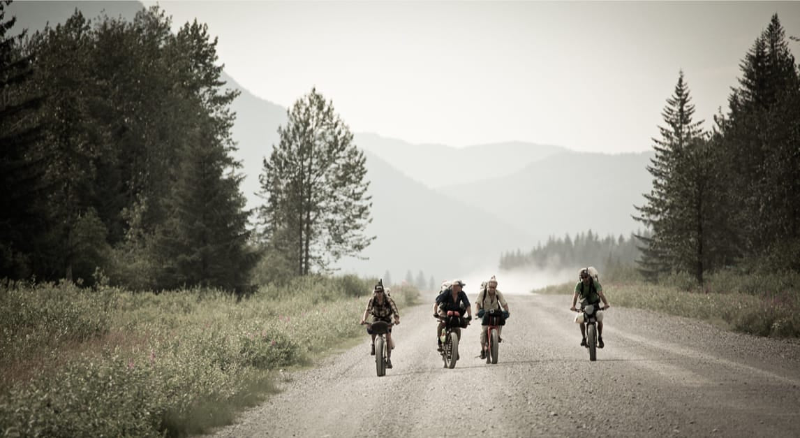
Final details buttoned up, we got our pose on then spun down a dusty road.

Perhaps inspired by the views in every direction, our pace could only be described as hauling. I was borderline spun out, panting, and running ragged for the 15 miles to the Flag Point bridge over the Copper’s westernmost channel.

Roman broke the spell and dove in headfirst, riding down the dunes and along the channel before stumbling through a balls-deep crossing. We pushed when needed and rode when possible, savoring backlit peaks, tracks of megafauna, and perhaps the last semblance of relative dryness on our persons. Just because it was wet did not automatically mean we could inflate the packrafts and end our foot sloggling. A minimum depth of water is required for that, and we needed to get further east to find a proper channel.

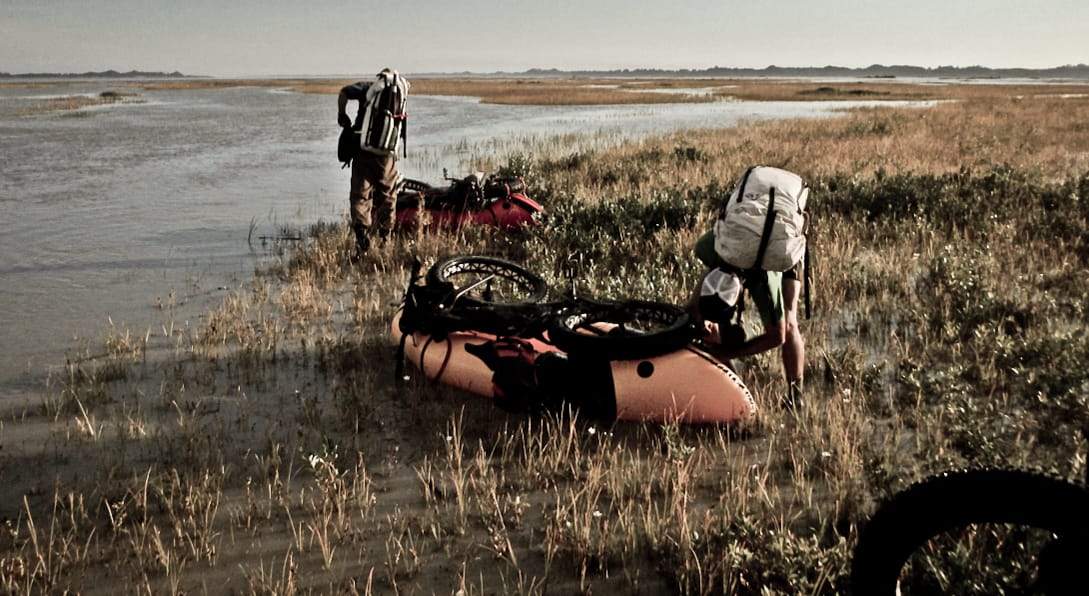
The next step involved inflating the boats to use as sleds, to drag our fatbikes with less overall effort.

Eventually we arrived at the last and tiniest slice of what one could exaggeratedly call “land”, with a marginal current beyond. There we sloshed about ankle deep while adding layers, donning drysuits, stuffing gear inside drybags or the tubes of our boats, then shoved off into the Copper proper.
Given that the gauged flow near this spot was a comfortable 260,000cfs, one might forgive us for assuming that we’d have the benefit of lots of current pushing us toward the ocean. Alas, it simply didn’t work that way. That’s an enormous volume of water any way you slice it, but to get at the whole equation one must consider the width of the channel that water is filling.

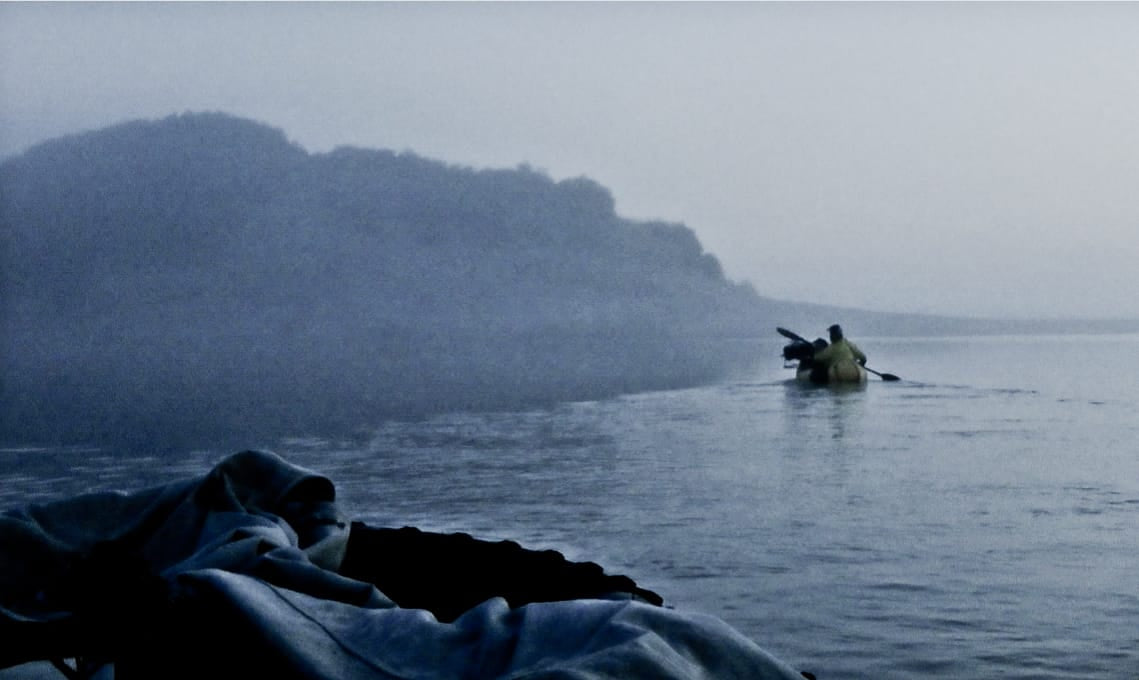
At roughly eight miles across, the water never seemed to get more than a few inches deep. Reading the current was challenging to the point of frustration, as fog had rolled in and obscured all landmarks. Our only reference points other than ourselves were seals, flotsam, and occasionally the moon would poke through the gloom. Often we’d run aground a sand/silt/mud bar and have to slosh around to find some depth.
Realizing that our initial plan of making it to and through Softuk lagoon before shutting it down was simply not going to happen, we used Gaia to navigate to an island. There we erected shelters, donned dry clothes, and kindled fire to heat water for a late night snack. Spirits were high given that we weren’t paddling and sloshing through the manky murk in the wee hours. But deep down we knew the score: That Jaybs had a plane to catch and a place to be in a little over a week, and after half a day of travel we were already half a day behind schedule. We drifted off knowing that we’d have to make that time up somewhere.
 Day Two:
Dense fog loomed and billowed through camp throughout the short dark hours, all through breakfast, and ensured all of our kit was saturated as we packed up to get back on the water. On-water visibility was good enough to see suspicious seals but not much else.

As we ferried ever left, 45 to 50* across the current of the river, we could hear diesel engines somewhere out there. We knew they were fishing boats scooping up reds by the millions, thus we endeavored to head in their general direction — with the understanding that they’d be in deeper water with stronger current. What we’d forgotten is how well sound travels over water. Eventually it occurred that those diesels were 10+ miles away, out at the edge of the delta. It’d take us many more hours to slog and slosh our way there.
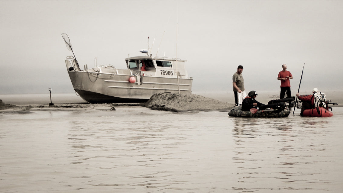
At the far SE end of Softuk Lagoon we dragged our sodden carcasses ashore and packed, finally, to ride. The beach was glorious — firm and fast. Spirits were high as we left the tedious travel of the delta and steamrolled into the evening.

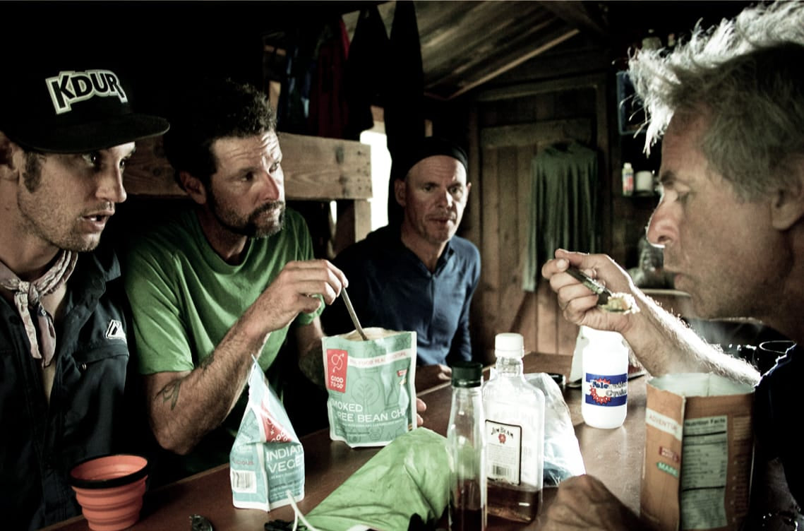
A public use cabin appeared on the beach right about dinnertime, and who were we to say no to an out-of-the-wind-and-spray-and-bugs place to sit and cook and relax?
Hauling ass for a few miles along mirror-smooth beach had lifted our spirits and hopes substantially. But now, almost 2-days into our trip, we were already a full day behind our must-make schedule. Had we been overly optimistic with this itinerary? Or was the riding to come really that good? I can’t speak for mis amigos, but I was hoping against hope that it was.
Day Three:
Overnight our weather emphatically shifted. New normal was low ceiling, low pressure, flat light, wind and spittle from the southeast. Little did we know this was as good as it would get for the next ~5 days. It felt like summer had just been kicked to the curb by fall, and fall in SE AK means inches of rain per day.

As we neared the edge of Kanak Island the tide was mostly out, exposing vast flats with short channels between them. Below the boys are clustered discussing whether to stay on the mainland and keep riding, with the likely result that we’d need to break out the packrafts for one or two bigger crossings later. Ultimately we decided to cross here, to the point of land just behind them. And once we landed there we could see another, shorter crossing maybe 5 minutes ride away.

Normally we’d deflate boats and pack up between each crossing, because it doesn’t take long and it’s far easier to ride with all gear stowed. But these crossings were so close together that we kinda figured “why not” and just lugged our inflated boats haphazardly from one to the next. It was crude and comical, but it probably saved us time. Ever the problem solver, Roman immediately devised a quick, easy, efficient means for attaching boat to pack so that he could ride more or less unencumbered for ~1/4 mile at a time. He’d arrive at the next crossing, drop the boat with pack still attached, drop the bike onto the boat, then climb on and paddle across. Eventually we all found a way to mimic Roman’s time-and-energy-saving hybrid bikepack / packraft discovery.
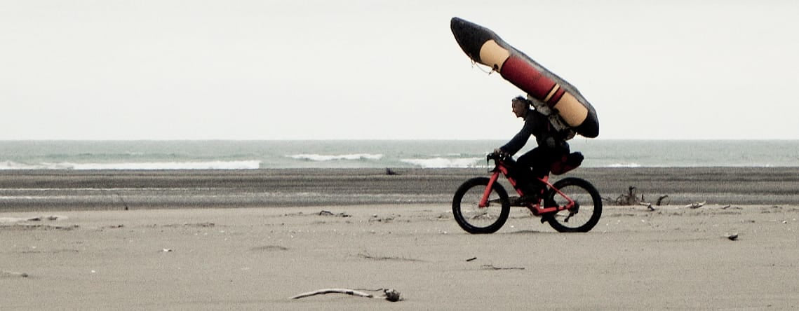
Eventually we arrived at the extreme southern tip of Kanak, where you need to cross Controller Bay to get to the Okalee Spit. Back in ’08 Eric and Dylan found such rough waters here that they hitched a ride on a bowpicker. Somehow we arrived at a low-low tide and found light winds, light chop, and a short ~20 minute paddle across. Having heard of the fast tide swings and having seen what Eric and Dylan experienced, we packed the boats quickly, carefully, and donned drysuits ‘in case’. Maybe 200 meters shy of being home free onto the Okalee, we came to a channel of uncertain depth. I stood right at water’s edge for a moment trying to gauge it, as though maybe it would be worth just wading, and in that moment sea level went from under my shoes to over them. I hastily unpacked my boat but before I could inflate it my bike was floating next to it! Needing to act fast before my belongings bobbed away, I leaned the bike on my hip, blew the boat ~2/3rds of the way up, then plopped in and sloshed across.

Once safely onto the Okalee we lunched briefly, stashed boats and paddles, then headed overland in hopes of finding a good bear trail back to the beach. This trip happened 3rd week of July, which is prime wildflower season at home. I’d actually had a bit of regret in leaving the peak flowers behind, because they are so stunning and so fleeting, and I simply hadn’t expected anything exceptional from the Alaskan flora.
Ahem. Shows what I know.

We *did* in fact find a bear trail, or at least tracks left by a bear big enough to make a trail anywhere it went. Moments later we popped out onto the beach, relieved to have good sight lines again.
Maybe 2 hours later we arrived at the western edge of Cape Suckling, another of the ‘cruxes’ that we’d learned about by listening to Eric and Dylan’s tales. We dropped bikes and scouted ahead, finding difficult but not impossible footing given our awkward loads. I’d misread the maps and expected to have many more such traverses in the next ~2 miles, thus I lobbied to launch boats and paddle around all of them at once. While whinily pleading my case Doom poked his head around the corner, then returned and reported that he could have thrown a rock to the next good riding, with no further challenges visible beyond. We unloaded gear from bikes and into packs, the better to carry them, and in maybe 30 minutes elapsed we were past the worst of it, repacked, and back to riding.

Engaging riding led us onward beyond Cape Suckling, and as we neared the Kiklukh River something odd caught my eye. It’s common to see all sorts of detritus and outright trash washed up on the beaches, but that stuff all rests horizontally, and this thing was a part of the vertical world. It resolved itself to be a tent just as two humans resolved to be themselves. We’d known Brad and John were en route a day or so ahead of us, but we didn’t expect to see them so soon. We exchanged hugs and high fives then quickly threw up our tents in advance of oncoming precip. We shared food, fire, stories and commiserations before wind-driven rain put an end to a very satisfying day.
Mike Curiak’s adoption of ultralight techniques and philosophies evolved slowly, he says, as garage gear and his own DIY stuff became increasingly available. But now, he simply lives light. Curiak also owns and operates LaceMine29, a company that builds high-end, hand-built wheels for 29-inch bikes, fat bikes and 650b bikes.

